Tuesday, January 30, 2018

Cherriots Need Assessment Points to Service Expansion

Cherriots' Board met last week, but unfortunately the meeting packet's not yet published to the web.

It would be nice to review the Legislative agenda, and in particular to see the "Service Change Proposal and Public Engagement Plan."

Needs Assessment
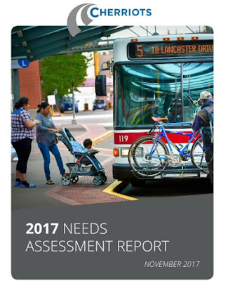
They have, however, published a major document that feeds into the service change proposal, the "2017 Needs Assessment."

That's worth a look, especially if you are interested in transit. (Hopefully the City's transit committee will have seen it also.)

This is not at all a comprehensive overview or summary, but here are some observations on things that stood out on a quick read.

Sunday, January 28, 2018

Belluschi's YWCA of 1954 gets some Love

It's nice to see the old YWCA building get some love in the paper today! It is one of the remaining buildings designed by Pietro Belluschi, and to my eye, the finest of those remaining.

Roberts House (circa 1870) before demolition in 1952
(Salem Library Historic Photos)
One new thing was a little more background on what the YWCA replaced:
The Salem YWCA moved to the Roberts House on the site in 1939. The house was built in the 1870s, and possibly earlier. The Capital Journal reported the building might have preceded statehood, with construction as early as 1858. It possibly was built as a church parsonage.

Saturday, January 27, 2018

House on 12th Street at Fairview used 1939 World's Fair Plan

House of Vistas pamphlet (detail) from 1939 World's Fair
(Art Institute of Chicago)
Now that we are more than 50 years removed from "mid-century modern," which makes architecture formally eligible for listing on the National Register of Historic Places, and which marks the generational skip that brings things back into fashion, one of the interesting questions here is: What mid-century architecture do we need to think about celebrating and preserving? (More on that here and here.)

Over at the Mill, they recently posted a picture of one of the more interesting mid-century buildings in Salem.

12th and Fairview looking south, then and now
Madrona hill in background (detail)

Friday, January 26, 2018

Prospects for State Street look a Little Dim

The Presentation to the State Street Corridor Committee has been published, and it doesn't look very promising.

More than anything, by themselves rents are not high enough to induce the desired redevelopment.

Four stories of retail and housing: Ideal

Doesn't pencil out
So we are in a terrible "between" state: Rents aren't high enough to attract new development and we don't actually want rents to go up because they're too high already. This is messed up.

Thursday, January 25, 2018

Crashes on Lancaster and Commercial Show Design Flaws

Earlier this week the paper had two narratives involving driver error. One of the errors was wildly negligent, multiple and catastrophic, the other a more "minor" instance of carelessness that was lucky not result in catastrophe.

But both of them were made worse by our overwide stroads, Lancaster Drive near Chemeketa Community College and Commercial Street at Keubler. On both of the streets, design speed is high, reaction time short, and stopping distance long. The crashes were fatal in one instance and "merely" dramatic in the other.

The primary cause in each was driver error, but our roadway design and our approach to speeds and traffic volumes were contributing factors that compounded the primary driver errors and made the consequences much, much worse.

At slower speeds, this crash
would be likely survivable
From the piece:
A Salem woman was sentenced to roughly 18 years in prison Monday for killing two teenagers and injuring a third when she drove her SUV over a curb near Chemeketa Community College in 2010.

Sophia Downing was traveling on Lancaster Drive NE on Sept. 23, 2010, when her Chevrolet Blazer careened across a sidewalk, hitting three people standing near Winema Place NE....

In 2012, Downing was convicted of two counts of first-degree manslaughter, DUI, reckless endangering and one count of second-degree assault. She was sentenced to 25 years in prison, but the Oregon Court of Appeals overturned her manslaughter and assault convictions in January 2016....

Facing a new trial, Downing instead pleaded guilty to two counts of manslaughter and one count of second-degree assault in December.
Lancaster Stroad at Winema Place - note the closed crosswalks
via Streetview
Lancaster here is wide and straight, optimized for speeding. The crosswalks at Winema have been closed because of all the conflicts: turning movements and lane changing and speed. Immediately south of the image there is an enhanced crosswalk for access to the bus stop, and I believe that was installed only after and partially in response to Downing's crash. But it is retro-fitted into the road and the road's posted speed, and is in no way a fundamental and structural shift to the design of the road itself.

Wednesday, January 24, 2018

She Walked Away from Omelas

They keep walking, and walk straight out of the city of Omelas, through the beautiful gates. They keep walking across the farmlands of Omelas. Each one goes alone, youth or girl, man or woman. Night falls; the traveler must pass down village streets, between the houses with yellow-lit windows, and on out into the darkness of the fields. Each alone, they go west or north, towards the mountains. They go on. They leave Omelas, they walk ahead into the darkness, and they do not come back. The place they go towards is a place even less imaginable to most of us than the city of happiness. I cannot describe it at all. It is possible that it does not exist. But they seem to know where they are going, the ones who walk away from Omelas.

If aren't living under a rock, you'll know Ursula K. Le Guin died Monday. Her fans will already know this about Omelas, but others likely not: She memorialized Salem in one of her short stories, "The Ones Who Walk Away from Omelas."

Tuesday, January 23, 2018

State Street Corridor Study Advisory Committee meets Today

Tonight, on Tuesday the 23rd, the Advisory Committee for the State Street Corridor Study will meet at the Library at 4pm to talk about the proposed zoning.
The committee will review revisions to the proposed mixed-use zones on State Street as well as an analysis of development feasibility. The committee will also discuss the preferred street design
The chief element that seemed to be contested were the building heights, and both the MU-1 and MU-2 list 55 feet as the maximum at the moment.

At least in the published materials, it has not been discussed whether this will actually attract the development we want to have. Would 70 feet actually spur more reinvestment there?

It might seem great that the heights have been reduced in response to neighbor complaints, but if the reductions are such that they hamstring the whole concept and hinder or even halt the desired redevelopment, maybe the reduction isn't such a great idea after all.

Presumably the "development feasibility" discussion will touch on this.

Parking in back, forecourt alcove, corner entry
Still, there are lots of good things in the two zones:
  • The fronts of commercial buildings meet the sidewalk and have lots of windows
  • Forecourt alcoves can be featured as pockets of quasi public space
  • Parking in back
As for the street design, we should continue to lobby for a full 4/3 safety conversion. Doing it only half-way compromises its effectiveness!

Monday, January 22, 2018

Brown Road Completion Funds and Start on McGilchrist ROW at the MPO

The Policy Committee for our local Metropolitan Planning Organization meets tomorrow the 23rd, and it looks like they are ready to send out a formal proposal on the $5M in bonus funds from changes to the Congestion Management and Air Quality program.

Recommendation: Top 4 get full funding, next 3 partial
The Technical Advisory Committee landed on a recommendation, and the Policy Committee can endorse it unchanged or make changes. (It will be interesting to see if it happens that the PC and TAC are out of step on this.)

Once the recommendation is ratified by the committee at the meeting, it'll go out for a 30 day Public Comment period, and then next month they'll make formal adoption of it.

Under this recommendation, the top four get full funding:
1. Brown Road NE Sidewalk and Bike Lane
2. Center St: Lancaster to 45th Pl NE Upgrade
3. SAMTD Transit ITS Project
4. McGilchrist Complete Street Project ‐ Right‐of‐Way

The next three get partial funding:
5. Connecticut Av: Macleay to Rickey West Side Bike/Ped
6. Wheatland Road Multimodal Corridor Plan and Conceptual Design
7. Turner Road Downtown Urban Upgrade

Orchard Heights is out of luck:
8. Orchard Heights Road NW Pedestrian Improvements and Pavement Preservation

At the point, the main question seems to be whether the Center Street project is sufficiently up-to-date with best practices for car travel speed and lane width, as well as its deployment of bike lanes and sidewalks. (Some previous discussion here.)

As far as the disposition of funding goes, given the actual projects that were submitted (which is to say, we might wish that local governments had submitted juicier projects for congestion relief and air quality), it's hard to argue with the way it shook out. It might be nicer to see the Connecticut Avenue project get full funding, as it is so near a school - I'd swap out the Center Street project for more design refinement - but Center Street is an important corridor and connection to Lancaster. Orchard Heights indeed seemed like a low-priority and odd project to try to slip into the funding process. Altogether the recommendation easily meets the test of "reasonable people can disagree."
Saturday, January 20, 2018

City Council, January 22nd - Lone Oak Road and Subsidies

Council meets on Monday, and they'll be considering a proposal for a "Reimbursement District" near the Creekside Golf Course to fund extensions on Lone Oak Road.

Lone Oak Road in 2014, looking north
at Deadend to North Extension - Streetview
Proposed Reimbursement District
Going back to decisions made in 1990, and with elements reappearing in several since then, it's all very complicated and and confusing. Here we won't be able to trace out all the implications or come to anything close to a full understanding. (If you see an error, say so!)

A year ago over at SCV there was a note and video about one of the elements in the debate. A little before that LUBA remanded a case involving approvals for a four-lot subdivision at the golf course itself.

LUBA said:
[The second approval from 2003] UD03-1 contemplated that its phases would be ultimately connected by an extension of Lone Oak Road, which includes a bridge crossing over Jory Creek (Lone Oak extension). PUD03-1 included Condition 4.d, which required construction of Lone Oak Road, but provided no particular schedule or timing for construction. Instead Condition 4.d provided that “construction may be staged to support phasing of the development.”

[...]

Petitioner [the developer] argued that development of the four lots created by his application would generate only minimal traffic, and the traffic impacts would not be proportional to the million-plus dollars it will cost to construct the Lone Oak extension, not including the cost of the bridge, as required by Condition 3 [of the current matter in dispute].
As I read this, basically by not building out all the lots at once, the developer hopes to evade the requirement to build the road and bridge. It's death by a thousand cuts strategy or a kind of Zeno's paradox: Taken singly and in isolation, no single four-lot unit will ever create enough traffic impacts to warrant the Lone Oak extension and bridge. And if there is no provision to assess things by cumulative impacts, no future four-lot unit will ever trigger the requirement. And by the end, when every four-lot unit is built out, the extension and bridge will still not be built.

The proposed District at Council now includes a fee of $9,212 per lot at Creekside itself, and it may be that the proposal for the District is a partial response to this problem of cutting up that development into four-lot bits in order to evade the requirements conditioned on the traffic impacts. (It's all complicated, and much of the Staff Report seems to require an understanding of a subtext that seems like it cannot be spelled out explicitly for one reason or another. It's also interesting that the bridge across Jory Creek is also a condition of a different development. Has something shifted? So tangled!)

In any case, here we are with a different development and different developer, and the extension and bridge still need to be finished.

Friday, January 19, 2018

Influenza Warnings Today Recall those of 1918

Asahel Bush, Estelle Bush Thayer, Eugenia Thayer, circa 1910
Eugenia died in 1918 from the flu
(Salem Library Historic Photos)
A century ago during the winter and spring of 1918, coverage of the flu was intermittent, but it picked up in mid-September with nearly daily articles about flu overseas, here in major metropolitan areas, particularly in Boston, as well in as military camps. By mid-October, it was a local story. Portland's first cases had been identified and the city of Portland had instituted early closing hours and quarantine regulations on October 10th.

Today
As the exact 100th anniversary approaches later this year, we'll return to this, as it will be interesting to learn more specifically how the epidemic affected Salemites. From its earlier anniversary, we already know McKinley School was temporarily used as a hospital. Though she contracted the flu in Berkeley, a member of the extended Bush family, Eugenia Thayer, died on October 18th and was one of the earliest fatal cases with ties to Salem. Between World War I and the flu, it was an anxious time.

(Here are some additional notes on Portland and on Eugene.)

October 16th, 1918

October 21st, 1918

Thursday, January 18, 2018

Will Smart Growth and the Salem Model Really Lead to Success?

Over at SCV there's some cautious optimism about our new Community Development Director and his endorsement at Monday's Council Work Session of the policies and actions of "Smart Growth."

It is interesting that Chuck Marohn of Strong Towns has criticized the approach:
I really dislike being called a Smart Growth advocate....It feels designed to be inoffensive to everyone in a kind of disingenuous way.
One particular problem is that Smart Growth still may have a bias for new greenfield development - though it is "new and improved" with better urban form. Crucially, this kind of development is still autoist and still invokes the life cycle problem: What will fund infrastructure replacement in the second and third life cycle? A Smart Growth paradigm may not give sufficient weight to the values of redevelopment and of incremental development in already built-up neighborhoods.

Monday, January 15, 2018

Ice Rink Success, a Dam Proposal, Eugene Parking Meters - Newsbits

There's a positive assessment of the ice rink project on the front page today.

With the Riverfront Park planning process, some have argued against adding more things to the park and keeping open "green space."

But in off-season moments, the park is very often empty. There are plenty of slack moments in the spring and summer, also. The park's value is in actual use, not in holding it empty, in reserve, for potential use.

Saturday, January 13, 2018

City Council, January 16th - Strategic Plan Work Session

On Monday Tuesday! Council meets for a formal Work Session on the Strategic Planning Process.

The Plan really is still in early stages, and it may not be very useful to criticize or to praise it too closely yet.  So I'm not sure what is the right amount of comment. You will see other angles for comment. There's a lot of information to try to coordinate, and the Staff Reports still are mostly written as discrete pieces, not always or necessarily placed in the context of the whole. Council will need to come to some kind of synoptic view, but for the process to be most successful, that holisim will need filter down and inform basic reporting and analysis more fully. There may be some internal culture changes and anti-siloing that needs to happen farther down in the org chart. (It would be interesting to learn more about any internal debate or criticism of the process. Does Staff fully embrace the concept?)

Planning Trade-offs?

Because of our interests here, maybe you will say this is cherry-picking, but it is interesting to note that the updates that involve transportation and Public Works are among the least detailed.

This is an empty update!
It is possible that, for example, the choice to continue work and staff time on the SRC means that the City is slighting work for the Public Transit Committee. The Public Transit update is utterly empty. Anything meaningful is deferred to a future presentation to Council.

So is this an indirect result of continuing work on the SRC? Hard to say, but it's certainly possible.

Tuesday, January 9, 2018

Travel Feature on Salem in Popular Mechanics for January 1918

Maybe policy at the MPO's not so interesting for you. How about this lengthy piece in Popular Mechanics from 1918? Apparently they had a regular travel feature, and in January they wrote about Salem.

They seemed to be drawn, not surprisingly, to details on street construction and the role of forests, wood, and wood products. So it's not a comprehensive look, nor is it really very touristy. But it is interesting nonetheless.

The Capital Journal noted some errors and misunderstandings, and this response is at the end of the post.


At the MPO: Work Program and Rule-Making Updates for the TAC

The Technical Advisory Committee for our Metropolitan Planning Organization meets today, and there is no important action item.

But the agenda does have a couple of other things to note.

Work on the formal Work Program continues, and if there is any sign that the remand by LUBA on the land use matters had any real consequences, I'm still not seeing them. On the SRC it says:
The final planning work on the Salem River Crossing Study EIS (Environmental Impact Statement) should be concluded in 2018. The lead agencies for the EIS are ODOT and city of Salem with SKATS staff on the project management team. As of December 2017, many of the technical sections of the FEIS were going through their final review; the City of Salem and Polk County are coordinating on the land use and Urban Growth Boundary issues with the state. SKATS staff will continue to coordinate with ODOT, the jurisdictions in SKATS, FHWA, and FTA on any needed planning work before and after the FEIS and Record of Decision (ROD).
What the heck does "the City of Salem and Polk County are coordinating on the land use and Urban Growth Boundary issues with the state" mean? That sounds like a sneaky work around!

There's nothing to coordinate until the City holds a new set of hearings! But apparently the LUBA decision is not very consequential, and there seemingly is much to coordinate.

Something's amiss here.

More pleasant are some of the "draft Transportation Planning Rule Performance Measures." (See the full rule-making site for more background.)

Measuring Bike Level of Stress

Monday, January 8, 2018

What is Killing Oregonians? Driving! - Also, Morningside NA

There's a front-page article today tabulating the top causes of death for Oregonians in 2016.

Number three on the list, "unintentional injury," includes "motor vehicle crashes" as one of the "most common factors contributing to unintentional injury" death.

While noting a large increase in traffic violence, it says "Oregon ranks among the states with the best transportation safety laws" and also quotes the State Epidemiologist and State Health Officer, who says “Driving under the influence of drugs or even distracted driving by texting while driving are both big problems that contribute to these deaths.”

But of course the bigger, unacknowledged problem is that we are driving more. The count of deaths tracks closely with vehicle miles traveled.

Sunday, January 7, 2018

Grant and Bush, Transit and Cars, Cap and Invest - Newsbits

Just some passing comments on weekend news...

Grant and Bush

I'm not exactly sure what the right standard is here. Most of the time the paper's history columns are informal, chatty, fun, and not something to fuss over. But this story about a juicy scandal at Ladd & Bush bank seems half-baked. It's a tricky narrative, and probably needed a much longer word count. Maybe editing whacked it down too much. Whatever the reason, it flattens out too many elements in the story and is hard to follow.

First off, it's time for a more nuanced sense of President Grant.
Let’s set the stage for this bizarre tale. It’s 1876, and the Republican Rutherford B. Hayes is running against the Democrat Samuel J. Tilden of New York. Both candidates are running on a platform of reform, seeking to counteract the corruption of then-President Ulysess S. Grant. Grant’s scandals were so bad that he had split the Republican party. Fellow Republican Senator Charles Sumner of Massachusetts even coined the derisive term “Grantism” and gave a speech on the Senate floor differentiating Grant’s activities from the core values of the Republican party.
Just a reminder: Under Grant in 1870 the Department of Justice was created, he signed the anti-KKK Enforcement Acts, and the 15th Amendment on voting rights ratified.

Friday, January 5, 2018

City Council, January 8th - Rectangular Rapid Flashing Beacons

Council meets on Monday, and in what is otherwise a minor matter for the acquisition of a strip of right-of-way along Portland Road, there is now the question of what to do about the flashing beacons we have been seeing at crosswalks.

FHWA memo terminating permission for
flashing beacons at crosswalks
Just before Christmas, the Federal Highway Administration withdrew permission for use of Rectangular Rapid Flashing Beacons. Currently we have some installed on Commercial Street at Bellevue by City Hall, on 12th Street at Mill, and on Court and State Streets by the Capitol. City Plans call for them at several new locations on forthcoming street projects.

One set of these future installations is on Portland Road.

Rectangular Rapid Flashing Beacons were to go here
So at this moment, the drawings the City is sharing on the matter of the ROW acquisition are obsolete, and it would be interesting to learn how the City plans to alter the crosswalk configurations. Presumably they will just "downgrade" the signs to eliminate the flasher, but crosswalk compliance by motorists is perennially difficult, and the flashing lights seems to help a great deal with the reminder to stop for people on foot.

Wednesday, January 3, 2018

The Prospect of more Biking on Paths in Salem

Things are still slow at the start of the new year, and without much in the way of substantive things to think about, maybe it is a little interesting to consider - even overreact to, since there's not enough talk yet to conclude there's a legitimate trend really - recent murmurs about biking on path systems.

Without a strong commitment to separated bike lanes on busy streets, a commitment to a separated trail system is inadequate. Too often the trail system becomes an attempt to get non-drivers out of the way of cars.

You might recall the proposal for a temporary path on a Marine Drive alignment from the past couple of years in the SRC debate.

More recently, though we haven't yet seen a list of proposed bike share stations from Capitol City Cycleshare or from the City, last month they posted a note from one of the charettes for the update to the Riverfront Park Plan, and it showed some docking stations in the park itself.

Snapshot from a charette board with Capitol City Cycleshare
Over on the Council FB group, a person posted a note about Dutch "cycle highways," and in response another person writes:
I am so frustrated with ODOT and their Bicycle Planning office. They insist that bikes be in bike lanes within the right of way. Local governments follow those rules. As a bicyclist I always considered that dangerous, i.e. being passed by semi-trucks by inches. We've had kids killed in Salem by passing trucks. The Radburn system simply plans vehicular roads as separate from pedestrian bike paths. Again, Sunriver or Black Butte are local examples of communities that are intelligently planned. I worked on Livingston new town. Other good examples are Stevenage, Harlow, and Cumbernauld. The last one is a Scottish hill town with the shops at the top of the hill, then radiating paths to the neighborhoods. Vehicles are a totally separate network, with of course no sidewalks.There are some good ones in Sweden and Denmark also.
So there's a small cluster of some sentiment in favor putting bikes on dedicated paths apart from the street system.

That sounds great, but there are reasons it might be concerning.

Tuesday, January 2, 2018

Happy New Year - Baggage Depot is Almost Done

Hope everyone had a safe and pleasant New Years!

The Baggage Depot isn't quite open, but the new bus loop is
The Baggage Depot at the Train Station isn't quite open yet, but they've removed some of the fencing and are using the paved loop now for both Greyhound and Amtrak buses.

Apparently this started on December 18th - the ill-fated day of the Cascades derailment near Olympia.

Looking through the windows and doors of the Baggage Depot, you can see a mix of old and new. Some weathered old "barn doors" look to be preserved on the inside, able to slide over the apertures of the new doors. By contrast, there's a modern concrete floor it looks like - though I suppose it might be very old and just refinished and smoothed - and most of the furniture and fixtures are modern. It's funny to see a modern pair of drinking fountains in front of the bathrooms. There's no attempt to make the interior look old-timey. But a few vintage accents remain as reminders of its antiquity.

Once it's open, it will be interesting to see!

So that's a hopeful note on which to start 2018.