The City's announced a draft is out for review of the Cultural Landscape Management Plan for Bush Park and Deepwood.
 |
| Draft Plan out for review |
From here, while the plan touches on the way the parks are embedded in the larger Gaiety Hill and Bush Park Historic District, the plan does not give sufficient attention to relations across the park edges, especially the question of how people travel to the park.
Strictly speaking, this is outside the scope of the plan, but when we talk about trip end facilities like better bike parking, or of "gateways" at park corners, we should give more thought to how people arrive at the bike parking or at the gateways. Instead, the plan assumes people have already arrived.
 |
| Yew Park and Corner at Mission & 12th |
This is most apparent in the discussion of Yew Park. Yew Park at Mission and 12th really lacks its own identity as a thing separate from Bush Park and Deepwood, and it's also very disadvantaged by traffic. The draft plan specifically calls out "noise and auto pollution at this corner create an unwelcoming pedestrian environment." The Mission Street overpass, the 12th/13th couplet, the start of the Pringle Parkway, the railroad, and a wild spaghetti of multiuse paths together create a formidable barrier for people who might like to walk or bike. It's hard to reach the park area from the northeast, east, and southeast especially. This deserves more attention.
 |
| Potential gateway at Mission & High |
There is a lesser version of the problem at the corner of Mission and High. But it's not discussed very much either.
 |
| Tree damage from ice storm High & Mission, next to Gaiety Hollow (via On the Way) |
And yet, before Gaiety Hollow was built, the Lord family had had the whole corner, and there may be trees that date from Elizabeth Lord's parents' activity, especially her mother, who was active in garden and floral societies. The intersection of Mission and High, and its constituent corners, has seemed like something that deserves more attention for walking especially. Mission and 12th is really difficult, but Mission and High not as much. There is a latent energy at that corner to be tapped!
 |
| Why equivocation about climate? |
The section on climate starts with a strange and discordant equivocation: "Whether the result of human action, natural processes, or both, we live in an era of increasing climate change." Are we still doing this?
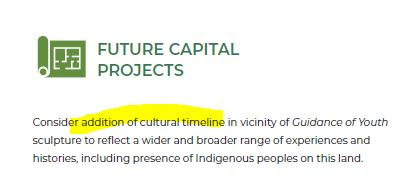 |
| We have a Guidance of Youth problem |
And finally, there is an oblique suggestion that Guidance of Youth is a problem that needs to be mitigated. (There are also sections of the plan omitted as they are still being written in partnership with the Confederated Tribes of Grand Ronde.)
On other topics, the ideas from the survey in December seem to be carried forward without significant modification, and there does not seem to be much to say on them. There does not appear to be any north-south axial enhancement for bike travel along a Church Street alignment. (See this note on High Street for more on north-south connectivity.)
 |
| Revive the historic carriageway |
 |
| Bike parking |
 |
| Bike parking, Lee St Bridge |
 |
| Bike parking |
The plan is long, over 300pp total, and there might be more to say later after digging into it more. There are many angles of approach to it. Oak preservation will be a special interest for many. The City also has a survey out on the draft, as well as some video conference presentations and discussions. See the project page for more detail.


3 comments:
A couple of points might deserve a little more.
If we are not going to have a low-traffic bikeway along a Church Street alignment within the park, then we really should make High Street a bikeway and put traffic calming or even diverters on it. Bush Park is all the area between High and 12th and is a kind of barrier to low-traffic north-south routes between Commercial/Liberty and 12th/13th. And if we are not going to make a connection through the cemetery, people biking on low-traffic streets from Candalaria and Sunnyslope likely drop down the hill and use a Bush Park route north of Hoyt/Rural.
As with some of the comments on the updated Geer Park Master Plan recently adopted, Bush Park really needs a Transportation Demand Management plan as a way to meet park demand without making driving trips and any parking lot expansion.
And until the sections written with the tribes are completed it's premature to have much of an opinion, but the "cultural" part of "cultural landscape" seems thin here, and I was expecting more. How, really, is this very different from a regular park master plan? Maybe there will be more to say on that later.
I'm speaking for myself only in this comment. This blog's suggestion about High Street is an very interesting one and seems consistent with (what I assume is) the City's current policy of limiting High Street to LOCAL auto traffic. (See the sign at the corner of Mission and High that says something to the effect that High St. is for local traffic). As a frequent bike rider myself, I use High Street rather than Liberty or Commercial or the Park, even though it sometimes means I have to go up Gaiety Hill. High St could be made better for bicyclists and even less of a auto through street by implementing some of the blog's suggestions. I would like that.
The "cultural" part of the CLMP does not seem "weak" to me. The oak groves and camas fields are certainly cultural and the CLMP spends a lot of time focused on protecting these. The spatial arrangements of many of the significant features of the Park (open fields, Bush buildings, orchard) are cultural features and these are also addressed and protected in the draft. Indeed, the draft arguably precludes the addition of any new features to the NW corner of the Park by recommending the application of USDoI standards, with some exceptions. And the Deepwood historic site gets lots of attention, with an eye toward restoration and preservvation.
It's not a perfect document, for sure. But I think it's a great draft. And it's really beautifully done, even if you just look at the pictures and enjoy the nice "look" of the document.
I encourage everyone to check it out and respond to the survey!
Christine Chute
Here is a follow-up on the "cultural" part. The plan here in late June was 300+ pp and 28MB in download. A new draft at Council on July 26th is nearly 900 pp and 82MB in download. Now, a lot of that is appendix stuff, but still it's a substantial amount of new material. The Tribal additions also do not seem very central. There will be more to say. I still find the cultural side underpowered, and that post gives some of the reasons why. Though of course this is very much a matter of opinion, and you may not yet agree.
Post a Comment