 |
| McGilchrist at the SSA Office: 40mph, no sidewalks - but watch out for pedestrians! |
It is great to see more discussion of the McGilchrist project. Commissioner Slater has very helpfully placed it on a Planning Commission meeting for an informational discussion at the least and perhaps a more detailed discussion and critique. This may be a result of the Commission's recent move to assert a stronger "advisory" function on City Planning. This is an excellent development!
Meanwhile, on FB there was a long response from the City.
 |
| via FB |
The response was not in fact very helpful, and mostly recapitulated materials and framing from the grant application. It did not respond much to the substance of any critique.
 |
| From the 2022 RAISE application |
The first claim:
The street lacks sufficient width to safely accommodate current traffic volumes and freight movement.
The grant application shows two 11-foot travel lanes in the current configuration. The street has been posted for 40mph.
On lane width, the National Association of City Transportation Officials concedes 11 feet might be necessary in some cases, but cautions against anything wider:
For designated truck or transit routes, one travel lane of 11 feet may be used in each direction....Lanes greater than 11 feet should not be used as they may cause unintended speeding and assume valuable right of way at the expense of other modes.
The fact that the street has been posted for 40mph means we are ok with speeds up to 50mph there (recall we don't ticket until over 11mph over the posted speed). If the street in fact "lacked sufficient width" it would have a much lower posted speed.
The new cross section shows 11-foot travel lanes buffered by 2 foot margins (13 feet total) and a center 12-foot turn pocket. These seem overwide and will induce speeds above 40mph, which we should agree do not belong in the urban context.
The City's claim here may not be outright false, but it requires considerably more nuance.
 |
| From the 2022 RAISE application |
The City also says
There will also be a setback “cycle track” on each side of the street, which consists of a 10 foot concrete path that will serve both pedestrians and bikes.
First off, the cross section shows a multi-use path, not a cycle track.
Again from the National Association of City Transportation Officials:
A cycle track is physically separated from motor traffic and distinct from the sidewalk. Cycle tracks have different forms but all share common elements—they provide space that is intended to be exclusively or primarily used for bicycles.
By misusing a term, the City is misrepresenting what the cross section shows.
Additionally, figures 1, 2, and 3 here are excerpted from the very same page, the first page, of the 2022 RAISE application, and figure 3 shows a paint-only bike lane, not the multi-use path.
 |
| Inconsistent bike lane drawings |
This is verging on a bait-and-switch. They show a multi-use path as if it were continuous, but the drawings actually show very little multi-use path between 12th and 25th.
The City really needs to say clearly how extensive is any multi-use path between 12th and 25th.
Not shown in the FB clip, but referenced later in the extended quote, McGilchrist is identified as a "Critical Urban Freight Corridor." This sounds important, but this is a concept developed in the last decade or so arising out of new Federal Transportation funding packages. Specifically, it was introduced in the FAST act of 2015.
 |
| "Freight supportive roadways" in 2011 RTSP |
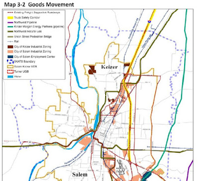
In the SKATS 2011 Regional Transportation System Plan, McGilchrist is identified as an "existing freight supportive roadway," but the formal designation "critical urban freight corridor" did not yet exist.
There is a circularity here: One of the reasons McGilchrist was designated an urban freight corridor was to support the various TIGER/BUILD/RAISE grant applications over the years. And now that we have one secured, the City appeals to that designation as a reason for the widening. By itself that designation does not tell us very much about the details and scope the City has actually chosen.
Again, more nuance is necessary to advance the debate and analysis.
Information that was helpful was the explicit naming of phases:
The project is planned to occur in 3 phases: Phase 1 – Realignment of the 22nd Street intersection, Phase 2 – 22nd to 25th, Phase 3 – 12th to 22nd.
The project is still going to be expensive. Because of drainage work, even without widening the car travel lanes, the sidewalks and bike lanes will seem expensive. But there are still savings and improved safety to be had from reconsidering the widths and number of the car/truck travel lanes.
This debate is great to see. And there certainly will be more to say later.


No comments:
Post a Comment