Showing posts with label Infrastructure Bond. Show all posts

Friday, October 27, 2023

New Union Street Drawings shown at the City Bond Committee Meeting

Yesterday the Bond Steering Committee saw some new drawings on the Union Street bikeway.

A new crosswalk and crossbike at the bridge

The City (and advocates too) really should stop calling it "family friendly," though, as it does not fully meet "all ages and abilities" standards. It relies too much on buffered bike lanes, and does not employ enough separation to meet a full "family friendly" standard. There's a good bit of "rounding up" going on here.

Union Street overview
(split into three, click to enlarge)

Even so, it will be a great improvement. 

Friday, October 20, 2023

City Council, October 23rd - Overlays and Sidewalks

At Council on Monday is final action on the compromise measure for the overlay zones along Commercial Street by Bush Park and the Cemetery.

Compromise on the overlay zones

Broadly, Councilor Nishioka's motion looks like successful legislation and compromise:

To eliminate the Oxford-West Nob Hill, Oxford-Hoyt, and Hoyt-McGilchrist Overlay Zones and amend the Saginaw Street and Superior-Rural Overlay Zones to increase the maximum height to 45 feet and remove all other use and development standards in these two overlay zones.

It's an improvement and addresses some, though not all, of the objections. Because the Oxford-Hoyt overlay has split underlying base zoning, it already has a height limitation even without the overlay, so neighbors' objections to height there is already accommodated. This allowed the matter of height to be finessed in the Oxford-West Nob Hill overlay and in the Hoyt-McGilchrist overlay.

Apartment zoning across from overlay

It was a little surprising, though, that it seemed necessary to retain height limits in the Saginaw Street overlay near Mission Street. That is mostly across the street from apartment zoning, and honestly seemed like the easiest overlay to delete altogether. But apparently that was not the case.

In any case, the resolution is incremental progress and it falls within the range of "what reasonable people can disagree on." On to the next thing!

New ramps at Winter and D Streets

There's an update on the City's Sidewalk Repair Program. One report shows the work on sidewalk and ramp repairs done in 2023, and another lists locations planned for work in the next six months. It's nice to see the cracks, heaving, and gravel fixed up!

Somewhat related is a process proposed to select and prioritize sidewalk and crosswalk work funded by the bond.

Saturday, August 12, 2023

City Council, August 14th - Crosswalks for 25th and State

In addition to the continuation of the appeal on proposed apartments in West Salem, the other big matter will be the payroll tax. Others have had good things to say!

Of more particular interest here is a report on five lots impacted with construction and small permanent easements necessary for the intersection work on 25th & State. The project includes 

construction of Americans with Disabilities Act (ADA) compliant ramps, one ADA-compliant driveway, installation of a cut-through median island, modification and extension of an existing median island, installation of street lighting, and signal improvements.
State St between 24th and 25th

The intersection is marked 25th on the map above. Though it's a dog-leg with a segment of 25th on the north side, the work is only on the section with existing crosswalks in line with the segment on the south side. A second dog-leg with 24th is also marked, but there is no work there. This part of State Street is five auto lanes wide, one of them a continuous center turn lane, and at 24th transitions to four auto travel lanes without a turn lane.

See previously:

Something to note is that this would be the transition to a 4/3 safety conversion if we can get there.

Evaluating the 4/3 safety conversion (April 2018)

Back in April of 2018, Staff indicated "a commitment" to "evaluate the lane reconfiguration west of 17th a year and a half after it is constructed" in order to see if the 4/3 conversion between 13th and 17th can be extended to 24th. That lane reconfiguration is in the bond project list, but is still a ways off, to be funded in the second or third tranche, and not in the current funded one.

Thursday, May 25, 2023

City finally Publishes Updated McGilchrist Plans

Today the Bond Oversight Committee met and in the supplemental packet was an update on the proposed McGilchrist project.

The current statement says 74% of the bike lane will be separated. Which is a distinct and unambiguous improvement on earlier drawings.

But the 26% legacy paint-only bike lanes are typically at intersections, where turning conflicts are most frequent. 

Here on 22nd you can see the green curb strips and the ramps going from the multi-use path in speckled grey (a little darker than the sidewalk segments) to the paint-only lanes on the street in solid grey.

McGilchrist at 22nd

The treatments at Pringle and the RR are also paint-only lanes with some advisory green striping at mixing/merge zones for turn lanes.

McGilchrist at Pringle and the RR

Maybe this is the best that can be done, but it still seems a little half-hearted. There might be more to say later with second thoughts.

Wednesday, January 11, 2023

Marine Drive and the Sidewalkification of Bicycling

The city's published another video on the bond projects. The first video, on Fisher Road, did not seem to merit comment, but this one on Marine Drive does.

City video on Marine Drive

On Fisher Road Mayor Hoy had talked with former Director of Public Works, Peter Fernandez, and in this one he speaks with Brian Martin, whom Staff Reports at Monday's Council meeting had identified as Interim Director of Public Works. The video may have been shot and edited before the City Manager made that decision.

Also Interim Public Works Director

Sidewalkification

They make a big deal about a 12 foot shared use path running on the east side of the roadway.

Plans for a 12 foot wide shared use path

The sidewalkification of bicycling is a little unwelcome. The path may function acceptably when the properties are not built out, but when there are meaningful volumes of people walking, biking, and otherwise rolling on them, there will be conflicts.

Saturday, August 13, 2022

A Disappointing Bond Proposal - Council Work Session, August 15th

Framed up as an ostensibly responsible thing for "maintenance" and "community improvement," the proposed City bond doesn't really meet our moment. It looks to a backlog of wants and needs, formulated in largely 20th century modes, but does not do enough to sift the true needs from legacy wants, and then to identify what our 21st century needs might be.

It's primarily a 4/3 safety conversion
and complete street rebuild:
That's an "urban upgrade."

Council meets on Monday for a formal Work Session on marketing the bond proposal.

All in all the project list and total package is not very inspiring. 

At the same time, as we see in the diminution and reconfiguration from Build Back Better to Inflation Reduction Act, making the sausage is rarely inspiring. If the proposed bond package isn't inspiring, it's not terrible either. Maybe this was the best that was possible. But enough seams, gaps, and questions remain in it to make boosting for a hard sell.

Rhetoric on Transportation Projects is Misleading

The way the City is selling it as something for walking and biking is mainly puffery and does not inspire confidence. The transportation section leads in the City marketing materials with a bicycle and pedestrian category. But that's misleading, suspicious even, and evidence the City is doing a little bit of the bamboozle.

Misleading categorization

The State Street project is $13 million for four blocks. It's not at all mainly a bike/ped project. It's a remodel for a "complete street" and a 4/3 safety conversion, and should be categorized instead as an "Urban Upgrade."

The Pringle Creek Path is a parks project, and belongs in the parks section.

That the McGilchrist project lacks a full set of protected bike lanes shows the City is not trying very hard. 

The evidence for strong walking and biking projects is considerably weaker than the City's rhetoric suggests.

Saturday, July 23, 2022

City Council, July 25th - Our Salem and new Climate-Friendly Rules

Our Salem is already a little outdated. On Thursday the 21st the LCDC (the board) approved new administrative rules on climate and city planning formulated by DLCD (the State agency).

Cover of the Staff presentation to LCDC

Some of the rule changes will supersede or modify policies and code for Our Salem, which Council looks to enact formally with a second reading on Monday.

From the DLCD press release

I guess the benefit is now City Staff get to point the finger at the State when people complain, so in there is political cover in that sense. "Our hands are tied."

But it's also disappointing the City isn't following our Climate Action Plan and going further on their own. (See a little more on the passivity and reaction in "Climate Action Plan Committee: Transportation and Passivity.")

I am sure Staff will come to Council later with an update on another set of code and policy changes to bring Salem into compliance with the new rules. It will be interesting to learn where exactly are the new inconsistencies. There is also an explicit set of new tasks the rules assign to each city and area. (The chart is too abbreviated to be very legible, and obviously there will be more to say about it later - but it gives a holistic sense of more work to do.)

Salem area compliance tasks

In the meantime, at Council for Our Salem the second reading is broken up into four pieces:

Staff identify next steps:

  1. Update the Transportation System Plan to align with the updated Comprehensive Plan
  2. Update the Comprehensive Parks System Master Plan to align with the updated Comprehensive Plan
  3. Coordinate and implement strategies in the Climate Action Plan
  4. Conduct a new Economic Opportunities Analysis
  5. Conduct a Goal 5 inventory
  6. Develop a Housing Production Strategy

And to this we will add a seventh, which itself contains multiple actions (see chart above): 

7. Update everything for compliance with the new Climate Friendly and Equitable Communities rules.

Friday, July 8, 2022

City Council, July 11th - MLK Parkway

After the proposal to rename Center Street ran into difficulties, the effort shifted to the Parkway, and with blessings from ODOT and the Oregon Geographic Names Board, the way looks clear. 

On Monday Council looks to ratify and adopt the name change, to "Dr. Martin Luther King, Jr. Parkway."

To rename Salem Parkway

That seems like a fine move. The full name seems likely to be shortened to "MLK Parkway" in casual conversation, and the rhyme will help fix it in memory without any significant loss of meaning.

At the same time, it is a little odd that there is no public comment specifically in support of the shift from Center Street to the Parkway yet from our NCAAP chapter or Oregon Black Pioneers. More comment is sure to come over the weekend.

Here's how many Salemites would have been introduced to Dr. Martin Luther King, Jr., in what appears to be his first substantial notice in the paper, when he was arrested "on charges of violating Alabama's anti-boycott law" in 1956. His house, the piece in the afternoon paper points out, had been bombed the month before while he was leading the boycott. The morning paper does not appear to have published anything about him. Its corresponding piece about the boycott on February 23rd, and in immediate follow-up the rest of February, mentions Rosa Parks only. (See also an earlier note on the boycott that also mentions her, December 6th, 1955. Gaines Street still seems worth more discussion as a candidate for reconsideration.)

February 23rd, 1956

In other action, Council will get an information item on the initial approval and subsequent appeal of a proposed food cart pod in West Salem at Riverbend Road. The appeal claims there is not enough parking, will be too much noise, more garbage and rodents.

Tuesday, July 5, 2022

Climate Action Plan Committee: Transportation and Passivity

The Climate Action Plan Committee meeting originally scheduled for July 6th has been postponed to Monday, July 11th. They'll be focusing on transportation and land use this month.

LA Times, Sunday front page

First, though, let's take a brief detour to the newly amended infrastructure bond proposal. The City sent out a press release on Friday.

From the Friday press release

On the one hand, the Davis Road and Union Street projects are valuable, not bad ideas at all. (But again, Union Street is a restoration of a segment that had been cancelled, not some new expansion, and we should not oversell its significance as a new thing.)

But the "careful trimming" the City praises exemplifies the way we largely keep auto capacity untouched and instead cannibalize from other valuable walking and biking projects. Non-auto transport is still fighting over table scraps. Council and Staff funded the new inclusions with these deletions:

  • $450,000 by eliminating railing replacement from the 15th Street Bridge improvement (structural improvements will continue at $460,000)
  • $1.5 million from sidewalk infill
  • $1.29 million from sidewalk replacement
  • $3.96 million from Safe Pedestrian Crossings

The only time car capacity was touched is "$1.1 million by eliminating right turn lanes from the State Street Project."

The approach to the bond - for the next decade, very nearly the period over which we are supposed to reduce our emissions by 50% in 2035, it must be stressed - does not adequately respond to our climate crisis and the need to reduce emissions from driving.

"Complete Salem's sidewalk network" - TL03

After all, the Climate Action Plan says to "complete Salem's sidewalk network." We should be doing as much expansion of sidewalk and bike lane as we possibly can, not deleting some sidewalk and bike lane to fund other sidewalk and bike lane. These kinds of projects need to be additive. It should be more, more, more, not "balance." Even when there are other funding sources available, "new grant sources," we should push for the maximum on these, not retreat to a false sense of balance.

Sunday, June 26, 2022

City Council, June 27th - Thinking about the Future

As we "enjoy" a reversion to ordinary levels of blazing hot this weekend on nearly the one year anniversary of 117 degrees, it continues to be concerning that as the project list for the proposed bond has been formulated, and the City signals they will not ask for anything further in the next decade, we just simply aren't at all asking, "what in five or ten years will we wish we had included?" What will we regret omitting?

Oregonian front page today

Sure, carrying forward old wish-list repair and updates makes a certain amount of sense, but isn't there a large set of climate related projects that we are simply giving up on? What is the opportunity cost with the current bond proposal?

Interior page SJ supplement today

The list still looks backwards towards existing wish lists of unfunded projects and is not critical or strategic enough about what we think we will need over the next decade as our long, slow climate emergency continues to intensify.

(All previous notes on the bond here.) 

A few other areas on Council agenda also suggest too much thought to maintaining the old ways, or to very incremental change, and not enough to change demanded by the full magnitude of multiple crises and exigencies.

There is a "Service Level and Program Update" from the Police, and there are some ironies.

Friday, June 24, 2022

City Council, June 27th - Safe Routes to Schools and the Big Bond

At Council on Monday there is news of a suite of Safe Routes To Schools applications for funding from ODOT in the 2023-2024 cycle. 

A slightly revised bond proposal is also on the agenda.

Project locations for 2023-2024 applications

For the Safe Routes project applications, funded statewide by $26.25 million in this cycle, the City has identified seven projects, in rank order of priority [a few notes added in brackets]:

  1. Market Street NE at 15th Street NE: Install Rectangular Rapid Flashing Beacons (RRFB) on east leg of Market Street NE at 15th Street NE intersection, restripe existing crosswalk, install ADA ramps, and signage. Estimated project cost is $464,000; City would be requesting $371,000 and providing $93,000 in matching funds. Serves Englewood Elementary School.
  2. Market Street NE at Aguilas Court NE: Install marked crosswalk, pedestrian refuge island, street lighting, signage, and ADA ramps on the east leg of the Market Street NE at Aguilas Court NE intersection. Estimated project cost is $325,000; City would be requesting $260,000 and providing $65,000 in matching funds. Serves Swegle Elementary School [and also the new United Way cottage cluster].
  3. Silverton Road NE at Sedona Avenue NE: Install pedestrian crossing with RRFB, ADA ramps, signage, and street lighting on the west side of Silverton Road NE at Sedona Avenue NE intersection. Estimated project cost is $487,000; City would be requesting $390,000 and providing $97,000 in matching funds. Serves Washington Elementary School and Waldo Middle School.
  4. State Street Sidewalk Infill: Install new sidewalk on the south side of State Street between Oakmont Court SE and 49th Avenue SE. This project will connect to the new traffic signal anticipated to be installed at the intersection of Oakmont Court SE and State Street as a condition of development [at the former mushroom plant]. Estimated cost is $418,000; City would be requesting $334,000 and providing $84,000 in matching funds. Serves Mary Eyre Elementary School.
  5. Liberty Road S Pedestrian Path: Install approximately 300 feet of dedicated pedestrian path and retaining wall on the east side of Liberty Road S from Summit View Avenue SE north to Davis Road S. This project will connect to the new traffic signal anticipated to be installed at the intersection of Liberty Road S and Davis Road S as a condition of development. Estimated project cost is $1,009,000; City would be requesting $807,000 and providing $202,000 in matching funds. Serves Crossler Middle School.
  6. Pringle Road SE at Hillendale Drive SE Pedestrian Crosswalk and Sidewalk Infill: Install a pedestrian crossing with a median island, ADA ramps, and street lighting at the intersection of Pringle Road SE and Hillendale Drive SE. Construct sidewalk on the east side of Pringle Road SE from Morningside Court SE to Salishan Street SE. Estimated project cost is $1,832,000; City would be requesting $1,466,000 and providing $366,000 in matching funds. Serves Morningside Elementary School.
  7. Winter Street NE at Gaines Street NE: Install a raised pedestrian crossing on the south leg of Winter Street NE at Gaines Street NE intersection, a high visibility crosswalk on east leg of the intersection, ADA ramps, signage, and new stormwater facilities. This project was identified by the Winter-Maple Greenway Plan. Estimated project cost is $302,000; City would be requesting $242,000 and providing $60,000 in matching funds. Serves Grant Community School.

With recent news of cost escalations on bids, and with the competitive nature of the application process, probably a reasonable expectation is for two, maybe three, of the seven to be funded. In the last cycle the City applied for five and won three, but this round seems sure to be tighter. (See previous notes on the Safe Routes infrastructure program here.)

Add Union St., subtract bridge railings

Also on the agenda is a revised project list for the big bond and a proposal to put it on the ballot for November.

Friday, May 20, 2022

City Council, May 23rd - Next Steps on Bond

Council meets on Monday, and final adoption of Our Salem will be the big thing. At this point it will be a done deal, and there may not be very much to say. So that will be in a second post this weekend.

Most interesting is the next steps on the proposed Bond. The Staff Report has a troubling approach, proposing to diminish valuable projects and using the old "divide and conquer" strategy. It is interesting to see what is considered untouchable, and what is very much touchable.

In response to the overwhelming popularity of the the protected bike lane proposal (which is great to see), the City tries to say "look at what we are already doing!" and also says we have to wait on the meat of the bike lane proposal.

The Steering Committee recommendation [already] includes two total miles and approximately $10.9 million of protected, off-street, or buffered bike lanes, including missing links in the currently planned network. These links include the Pringle Creek Trail Connection, a multi-use path connecting Marine Drive and Wallace Marine Park, and bike lane facilities as part of the McGilchrist and State Street projects. Areas proposed for protected or buffered bike facilities not included in the Transportation System Plan (TSP) require a TSP amendment and a public outreach process as additional lane width may impact other policy decisions relating to street tree canopy, planter strips, on-street parking, and right-of-way acquisition from private property. Salem’s TSP is set to be updated with public outreach and engagement beginning in July 2022.

Perhaps the most salient fact on the protected bike lane proposal is that it is for busy streets rich with commercial destinations and for straight-line connections between commercial districts. But that's not what the City is talking about here as they deflect to projects currently proposed for the bond. The Pringle Creek Trails is a meandering parks trail. Marine Drive is an alternative to Wallace Road, and few non-park destinations will be on it initially. State Street is a short segment of four blocks only. It is an urban upgrade, a 4/3 safety conversion, not a bike lane project (remember, $14 million for four blocks). The current design for McGilchrist is the only one here that really meets the spirit of the protected bike lane proposal for a functional network. This answer by City Staff is only partially responsive to the underlying problem.

After the Work Session, a knowledgeable advocate wrote to Council with related concerns:

I found myself discouraged this evening when listening to the presentation related to “Upgrades to Existing Roads” as related to bicycle facilities.

Bike lanes “that meet the current standard” are not helpful in a city hoping to encourage more residents to choose active transportation. Using the “current standard” so as to avoid additional costs and efforts is not helpful for a city seeking to offer safe and comfortable transportation options to people who want to ride their bicycles. The “brave and the strong” are on the road and will stay there, but we “interested and concerned” ask you to not be fooled by paint and “current standards.” In this case, “current” means that they are in Salem’s Transportation System Plan. In this case, “current” does NOT mean a standard that is modern, popular, leading-edge, or even up-to-date.

In the Staff Report, the City also proposes to reduce funding for crosswalks and sidewalks.

Friday, May 13, 2022

City Council, May 16th - Bond Work Session

Council meets on Monday for a formal Work Session on the proposed bond concept and project list. They could move forward and proceed to place it on the November ballot, or they could ask for further revision.

Streets and sidewalks categories
(revised from City numbers)

As we noted last week, from here the streets and sidewalks portion is not persuasive, hardly responsive to climate and our need to reduce miles traveled by car.

The Pringle Creek path really should be under parks

There is a fake "bike/ped" category in it whose projects fit much better in other categories. State Street should be an urban upgrade rather than "bike/ped" project. The path project belongs in the parks portion with other paths, and does not fit as a "street" or a "sidewalk." The bridge railings does seem to have been reassigned. Between a new street and those "urban upgrades," there is too much capacity increase, about 2/3 of the subtotal. The City could also make better use of urban renewal funding for the McGilchrist project instead of using bond proceeds. Altogether the current proposal does not make significant progress on reducing driving and making walking, biking, and busing, or other non-auto travel easy and attractive. It's improvement on the edges only, not yet structural and anything to meet our climate needs.

Why isn't there better alignment on climate?

There are other reasons to question the whole, not just streets and sidewalks:

Saturday, April 30, 2022

Streets and Sidewalks in Proposed Bond do not Align Strongly with Climate Plan

The City's published the recommendation for the big Bond Measure. Salem Reporter also has a summary and overview. Council has scheduled a formal Work Session to discuss it on May 16th, and there will be more to say then.

The allocation (from Budget Committee materials)

At the moment, here's the streets and sidewalks portion in outline taken from the City's description. Comments here are in italics, regular script is quoted from the City summary.

If there is a theme here to the initial impression of the proposed bond, it is the lack of a big idea and total shape. The bond is a list of projects, a grab bag, and not something designed with a vision for climate or some other high value. What is the theme and narrative for the bond? The City calls it a "Community Improvement" bond. From here, that is vague and not super compelling. You might see the lack of a big idea, that it is not structured "top-down," as a feature rather than bug, however. It will be interesting to see what others have to say.
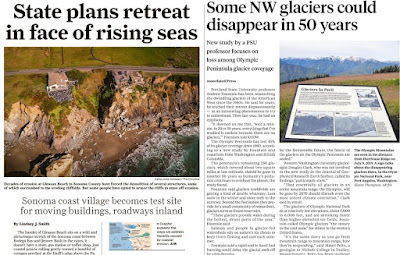
SF Chronicle (l) and Oregonian (r) this month

But if this is the big bond for the next ten years, as we look back at it from 2032 or 2035, will we be happy with it? Will in 2035 the projects for "community improvement" seem bold, merely adequate, or badly underpowered? We have some important targets coming up in 2035.

Except for Marine Drive (below), the City doesn't list dollar amounts in the summary so we know the relative weight of investment without drilling into the spreadsheets buried in the subcommittee's meeting agenda. Dollar amounts here are rounded to the nearest half-million and taken from the spreadsheet in the April 4th meeting packet.

The City leads with a "bike/ped" list, but the three projects are mere fragments, small segments, not at all part of a great increase in total network connectivity. They are also awkwardly placed in the category. 

Bicycle / Pedestrian Improvements (almost $20 million total)

  • State Street 13th St NE to 17th St NE Bike Lanes and Pavement; Pavement rehabilitation and striping reconfiguration to one travel lane in each direction with a center turn lane and bike lanes.  Includes a pedestrian crossing at 15th Street and streetscape features.  Also includes a new traffic signal at the 17th Street intersection with NB and SB right turn lanes on 17th Street. (About $14 million. If we assign the whole project to "bike/ped," that's really expensive for three blocks of connectivity! But of course there is a lot of car stuff in this also.)
  • Pringle Creek Path - Civic Center to Riverfront Park (half funding, anticipate grant for other half); Construct a pedestrian bridge crossing of Pringle Creek under the Commercial Street bridge, construct a new path along Pringle Creek from Commercial Street under the existing railroad bridge to the Riverfront Park.  Includes creek overlooks and art wall. (About $3.5 million)
  • Liberty Street NE and Church Street Bridge NE railings - replacement concrete railings, matching historic style at bridges over Pringle Creek. (About $2 million. Fixing the railings might be necessary, but this doesn't increase connectivity at all.)

The whole "Bicycle/Pedestrian" category is a little misleading. State Street is a 4/3 safety conversion, and it might be better categorized as an "Urban upgrade," along with McGilchrist, Fisher, and Pringle below. The bridge railings were originally a "Bridge Rehabilition" project but after April 4th got stuck in this "bike/ped" category. The Pringle Creek Path is really a Parks project. This category is not descriptive and doesn't work very well. It appears more for PR value, I think, so the City can say it has something big for walking and biking.

Thursday, April 14, 2022

2018 Plan for Fire Silently Informs Bond Discussions

Did you know we have a Strategic Plan for the Fire Department?

Though it was flawed and issued unilaterally without normal public process and public comment, earlier this year the new Police Chief published a "Strategic Plan."

The latest plan from 2018

Apparently in 2018 the Fire Department issued a similar plan. There may be an alternative process for emergency response and their fiefdoms. I don't remember seeing the plan at Council or any debate or discussion around it. Maybe I just missed it, as Fire isn't a core interest here, and at the time it wasn't something we would have examined closely here. (I also searched for "fire + strategic + plan" in the 2017, 2018, and 2019 Council agenda and came up with nothing.) But in general these two plans seem exempt from the normal public process we use for other types of important plans, and that might deserve more attention.

Apart from questions about that process, now with the the selection of projects for the proposed bond measure we have another process, and we should be paying more attention to the plan, including it in the debate and analysis about the bond.

11,000 square feet, mothballed in the 2010s
Fire Station 11 (Mackenzie architects)

The Bond Subcommittee meets Friday the 15th at 1pm, and in the packet is a memo that clearly shows its current shape and main buckets.

Main buckets in the current concept

The Civic Center seismic always seemed like a no-brainer, and it's nice to see the branch library concept. But do we really need $40 million for the Fire Department? We may not have quite enough for branch libraries and affordable housing in the current allocations.

Tuesday, April 5, 2022

Bond Candidate List looks back to 20th Century Standards, not Forward to the 21st

The bond selection subcommittee met yesterday, and they are beginning round up a list for the total package.

Except it doesn't really have a shape.

It appears to be mainly a grab bag of old projects we haven't yet managed to fund. It might be better to have a real vision for it instead of merely a scattershot collection.

Local coverage today on the UN update:
Oregonian front page, SJ supplement deep interior

With the new UN Climate Report out, and our own Climate Action Plan a little stalled, and also with Our Salem still in progress, it might be prudent to hold off, and not send it to the ballot in November. For it looks still too strongly to 20th century standards, and not enough to our 21st century exigencies. Even when the projects were identified more recently, the designs and project scopes themselves respond to best practices of the previous century, not yet to a vision of the city we want and desperately need to have in 2050.

If this is going to be the big bond for the next 10 years, our big opportunity, shouldn't we be including more assertive climate action in it? Without a stronger sense of vision and values behind it, and instead relying on older lists of unfunded projects compiled under a different set of assumptions, the list feels more than a little ad hoc and a la carte. The process almost looks like a set of competitive applications for inclusion in the funding source. 

A better approach might be to ask what high-level outcomes we want and then to select projects that instantiate those.

Here are a few notes on a small number of transportation items. It's hard to grasp a pattern, and perhaps later there will be a better way to nutshell things. Or maybe you will see things more clearly.

Friday, March 25, 2022

City Councilor, Cherriots Board President, Parks vice-Chair Float Protected Bike Lane Proposal

If you don't like high gas prices, you should support bikes!

For kids and for ordinary people

In a press release accompanying a proposal for a network of protected bike lanes, Councilor Virginia Stapleton, Cherriots' Board President Ian Davidson, and Parks vice-Chair Dylan McDowell underscore a message the City should lean into:

A comprehensive bike system would offer a safe, affordable, and carbon-free mode of transportation that is unaffected by fluctuating gas prices.

Climate, equity, and safety have not always registered widely, but high gas prices do. And right now is a moment.

The most resilient, patriotic way to manage high gas prices, is to get off the fossil fuel. The City should make it easier to convert some or all of your trips away from the car.

Wednesday, February 16, 2022

Curation and Categories: Public Art, Historic Landmarks, Bond Steering this Week

There are a few commission and committee meetings this week it might be worth mentioning. The Public Art Commission, Historic Landmarks Commission, and Bond Steering Committee all meet, and they show biases and blind spots.

Taste-making and Gatekeeping in Public Art

Last month

Today, on Wednesday the 16th the Public Art Commission meets and they'll be considering several items of public interest:

  • The 50th anniversary of the Civic Center and what we now call Peace Plaza
  • Public Art for the new Public Works building in progress
  • Councilor Stapleton's proposal for street murals and intersection art
  • An update on the Acid Ball Eco-Earth restoration

There is no meeting packet, no Staff Reports, there have been no minutes published for over a year, and the "selection committee" for the art at the new Public Works building is operating a little covertly. It's not the most important thing, but it's strange thing and not very public-minded.

No published minutes or packets for an entire year

With the kerfuffle over the unauthorized mural on Turner Road, as well as the enduring popularity of the Acid Ball Eco-Earth, the Public Art Commission should give more thought to the word "public" in their name. They don't have to give up a curatorial role entirely, but they should want to engage public tastes more than they currently do, and they should want to make their conversation more public.

Erasing Significance of Transportation

The Historic Landmarks Commission meets on Thursday the 17th and while the meeting agenda itself doesn't have anything to note here, the recent HLC newsletter on green buildings does have something worth comment:

Friday, December 24, 2021

Stabilizing South River Road Bluff a Candidate for new Bond Projects

Yesterday another landslide on south River Road fell from the bluff near Minto Park.

Via twitter

Today the City announced River Road would be closed for a while:

Due to continued safety concerns, it is estimated that River Road could remain closed for about 7-10 days. Cleanup of the River Rd S rockslide may not be safe until weather improves.

Maintenance of detour routes will be a priority until repairs can safely be made.

Here are a number of them (but not all of them), testifying to their frequency in the last decade. The combination of unstable bluff and road below create problems for all of the traveling public, not just those in cars.

Sunday, October 24, 2021

City Council, October 25th - Thinking about a Bond

Council convenes on Monday and they lead with a formal Work Session on concepts for a bond measure.

Cooking up a bond and figuring out the best ratio of bond sweetener to healthy food and good medicine seems tricky.

Still, the report on focus group testing has two things that just seem odd.

Nothing on climate

One is an omission. They didn't ask about climate projects. If this is the big bond for a decade's worth of projects, why aren't we planning for climate? This just seems like a very significant omission and lack of foresight. Of course, it is not too late to introduce that into the process.

The other is the decision to ask if people wanted free parking. Of course people like free! How is this useful information? Is the City considering a new parking structure a "bond sweetener" to make the whole package more palatable?