You will recall the image identified as "Wallace Road, seen in 1889."
 |
| Part of historical signage at Edgewater and Rosemont |
 |
| Dated to 1908 - West Salem |
Though the source of the particular image on the sign is the Polk County Historical Society, there are many versions of it floating around. There are postcards available on ebay and elsewhere with a tinted color lithograph of the image, "Oregon County Road," No. 7016 published by Portland Postcard Co.
Willamette University also has a copy of the photo, and you can zoom in on it. On a tree there's a sign for "Stockton & Co. Shoes."
 |
| Detail, via Willamette University Archives |
This must refer to J. L. Stockton.
 |
| November 24th, 1917 |
 |
| Buried in City View |
While the obituary in the paper says he opened a store here in 1891, that appears to be a decade off.
 |
| Sept. 4th, 1891 Independence West Side |
In 1891 he already had a store in Independence and a decade later in 1901 he was Mayor of Independence.
 |
| Big bonds and little bonds, May 11th, 1901 |
Not long after he completed a bond issue for Indy, a "popular loan" and something innovative in bond size and bond marketing, and perhaps something he conceived as his final act there, he announced a move to Salem.
 |
| May 13th, 1901 |
The store opened in July as "J. L. Stockton, The Capital Store."
 |
| July 15th, 1901 |
 |
| April 12th, 1905 |
By 1905, after a couple of changes in name, taking on a new partner, and buying out the Dalrymple and Holverson stores, in a shoe ad it was just "Stockton & Co."
This evidence suggests a sign for "Stockton & Co. Shoes" on the old Wallace Road is unlikely to date any earlier than 1904. The activity in Independence does not seem like a very good match, and even the first activity in Salem is not a good match. But the name in 1904-1905 is a match.
This supports a dating of c.1908 for the image. (Postcards and their stamp cancellations are also dated then.)
For many this will be just a trivial nit, not at all important. Here, the mistaken dating of 1889 seems to be an unconscious instance of autoist triumphalism, in which we retroject the adoption rate and supremacy of cars to earlier than is true. Look at that horse and buggy, of course that's 19th century!
 |
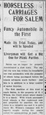
| April 16th, 1903 |
But there were lots of buggies and carts in service in 1908. The first automobile had just come to Salem in 1903. In 1908 horse-drawn vehicles were still very current technology.
Here are some in downtown in 1913.
 |
| Horse-drawn vehicles in the mixed-traffic ecosystem: Looking south on Commercial from Court, 1913 |
We overstate the speed with which they became obsolete and the speed cars became widespread.
 |
| Buggies in the city: Dec. 12th and Nov. 29th, 1921 |
There are regular crashes with buggies into the 1920s.
Placing the photo has also seemed like an interesting thing to try.
 |
| 1) Wallace's House at Salemtowne, 2) Harritt House and 3) Proposed location of photograph (1917 USGS) |
Just south of the 1858 Harritt House, situated on a small rise at No.2, and in the flat spot created by Glenn Creek as it emerges from the hill and comes down to the flood plain of the Willamette, there is a stretch on Wallace Road that appears to correspond with the geography in the photograph. I propose it is taken looking south at the spot marked with No.3 on the 1917 topo map. That is very near the contemporary intersection with Harritt Drive. Construction and tree grown don't show the topography very well in the streetview, so that direct comparison did not seem very useful to show here.
 |
| A false alarm on an early sidepath possibility |
At one time I thought the image might show one of the sidepaths associated with the 1899 Bicycle Path legislation, but I no longer think this. The "median" is not continued to the low hill on the horizon, and is likely just seasonal vegetation from the rains and spring. Moreover, Polk County never funded nor built any paths. Marion and Yamhill Counties did, but not Polk.
There might yet be other detail to tease out of the image. Finding out more about the origin of Postcard No. 7016 would be most interesting. More about the house on the far right of the image would definitely confirm the location. (Existing houses on that stretch do not seem to match.) The bond issue also might deserve follow-up. Maybe there will me more to say another time.


No comments:
Post a Comment