With the construction and new green crossbikes on Wallace at Edgewater, it's clear the City and ODOT really want to push the Edgewater path, tucked in and meandering a little between Highway 22 and Edgewater Street.
 |
| Dust, exhaust, zooming cars on Highway 22 |
I never use it because it's crappy.
It connects to no front doors of any businesses or other destinations. Edgewater Street itself is much more useful in that regard. And no business has a back door that connects to the path. Everything is fenced and hedged off.
Related to that isolation, it has hidey-holes for unsavory characters, and few eyes and ears on it. I would never use it after dark.
Where Edgewater is flat, the path runs up to the berm and levy for Highway 22, and the path has these low rolling hills and reduced sightlines. In several places it runs right along the highway, exposing you to dust, exhaust, and the sensation of traffic at highway speed. It's not comfortable at all.
As a line on a map it looks theoretically like it might be useful, but as anything a person directly experiences at ground-level, it is objectively terrible.
Orchardist or Capitalist? Our Public History of R. S. Wallace
Nearly a decade ago, out of the Vision 2020 project, the City installed "welcome" signs with maps on one side and historical, interpretive collages on the other. I had not seen the signs on the Edgewater path because they are hidden. If the City wants people to see them, they should be relocated to places where people actually want to travel, not deployed as lures to attract people to dead zones.
 |
| Historical signage on canneries |
Here's one near Patterson and Murlark, focused on canneries. It at least has an entry at Waymarking. (Since Oregon Fruit has moved, it's a little out of date now, unfortunately.)
Near the end of the path at the intersection of Rosemont and Edgewater, by the old West Salem City Hall, there's another sign on transportation history. This one is so badly sited at the highway off-ramp that even the crowd-sourcing at Waymarking hasn't taken note of it!
Though the sign is at Edgewater and Rosemont, fully half of it is about Wallace Road. Here is shows a dirt road with a wagon and horses, and says "Below is Wallace Road, seen in 1889..."
 |
| Part of historical signage at Edgewater and Rosemont |
The image is more recent than that.
 |
| Dated to 1908 - West Salem |
The pictorial history of West Salem published in 2011 dates the image to 1908.
Two decades, 1908 rather that 1889, seems right. There will be more to say about the dating and image in another post.
For the moment, let's consider the role of Robert Stuart Wallace. A theme here with Asahel Bush is that we don't pay enough attention to his banking and investment activity, and the way we see Wallace seems to echo this.
There is another sign at the Glen Creek entry to Wallace Park that is wholly focused on the park's family name. (You will recall that the park formally is named for son, Paul B. Wallace, not Paul's father, Robert Stuart Wallace. That's not a terribly important slippage, but it is a minor elision.)
 |
| Robert Wallace history (from 2014) |
Both signs are a little misleading in tone and emphasis. They are an instance of looking away from the power exercised by a wealthy
banker and landowner.
The copy on this sign also highlights Wallace's activity on the road. It ends with an altruistic note, a favor to the community:
Wallace set to improving the old wagon path from his farm into Salem. Using his own money to widen, grade, and maintain the road, it soon became known as Wallace Road. And true to form, Wallace shared it with everyone.
The photo caption in the West Salem book also stresses "at his own expense."
We should instead interpret the road building as a self-interested investment. Wallace was wealthy, a capitalist, and he needed reliable ways to get goods to market.
 |
| Wallace was wealthy, May 27th, 1887 |
On an 1887 list of tax assessments, Wallace was behind only Ladd & Bush, and the out-of-state principal owner of the Capitol Flouring Mills, William Stewart.
 |
| October 3rd, 1890 |
In 1890 he started a cannery opposite the Woolen Mill, on what is now the Willamette campus. A piece from October of that year says "a pile of money is necessary in the business to keep it going...." They were joking, but not really. Wallace was wealthy.
 |
| October 31st, 1891 |
Wallace's 1891 obituary says he was
principal owner in the Salem waterworks, president of the Capital National bank, principal owner and active manager of the Salem cannery and fruit evaporator...[he also] conducted another large enterprise, the development of an immense fruit ranch....
The Salem Online History (slowly being rebuilt at the Mill, but at the moment without this article, so this is from an archived version via the Wayback Machine) frames it this way:
Robert Stuart Wallace was an early Salem orchardist who developed the Wallace Orchards in the 1880's, a 330 acre pear farm. that was operated by the Wallace family until 1952 when it was sold to the developer of what is now Salem Towne. Mr. Wallace was an active business entrepreneur who founded and built the Capitol National Bank, owned the first cannery in Salem, built the first bridge across the Willamette, and operated the Salem Sand & Gravel and the Sydney Power Companies.
He was big business in Salem!
 |
| January 1st, 1907 |
The Wallace farm and orchard wasn't just a pear orchard. There was other fruit, produce, and probably livestock that all needed to go to the cannery and to market.
We should read the road work in conjunction with the establishment of the cannery. They occurred about the same time and they go hand-in-hand. Work on the road was a capital infrastructure investment for the cannery and farm.
The signs gloss over all this.
And when we hit the "orchardist" description as primary, the framing expresses a bucolic, agrarian bias, obfuscating him a little as capitalist. There is something of a fantasy of a gentleman farmer here. More of his activity was around banking, development, and infrastructure. The big, bad city of Chicago acts as a foil in our telling. From the archived online history again:
Robert Stuart Wallace lived in Chicago and operated as a commodity broker in the Chicago Board of Trade. The pressure of trading was so intense that his doctor told him he must quit this stressful activity or he would die young. He took the advice and sold his holdings and came to Salem, Oregon in 1885.
Back to the road, the sign at Edgewater and Rosemont has a couple more smaller images of Wallace Road.
 |
| More at Edgewater and Rosemont |
It captions the top image:
A work crew uses equipment and horses to grade a section of Wallace Road in late 1800s. The road connected the communities of Brush College and Spring Valley with West Salem and the ferries that crossed over the Willamette River to the Capital City.Even here there is a little bit of erasure. The road connected Wallace's farm and orchard to the Capital City! Connectivity for Brush College and Spring Valley was a secondary benefit, not primary.
Instead of interpreting Wallace's road activity as a neighborly gesture, we should understand it as a business investment, and analyze it more directly in those terms.
That sign on Glen Creek at the park entry does it better, but its tone is still awfully irenic, all about the generous patriarch:
In 1885, when Salem was growing from a territorial town to a bustling center of commerce and governance, Robert S. Wallace arrived here from Chicago with his wife and young children. Already a successful businessman, R. S. quickly got involved in his new hometown. He ran the Salem Water Company, founded a local bank (Capitol National Bank) and build Salem's first cannery along the millrace that is now part of Willamette University....Soon, the Wallace farm was like a small community itself - consisting of a summer house, various barns, a large fruit packing and storage facility, a few residential homes for farm workers and a huge orchard...Now, with his family and farm operations on the west side, and business operations on the east side - including his cannery and warehouses - Wallace set to improving the old wagon path from his farm into Salem.
At this level, these are not quibbles over facts. These are quibbles over tone and interpretation.
At least here, it seems more accurate to call Wallace a "capitalist," more than a mere "businessman," and the orchard but one of several investments rather than his primary identity and activity.
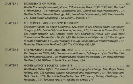 |
| Part of TOC from Merchants, Money, and Power: The Portland Establishment, 1843-1913 |
There is a very great opening in Salem history for something like E. Kimbark MacColl's book, Merchants, Money, and Power: The Portland Establishment, 1843-1913. With Asahel Bush, R. S. Wallace, John and Joseph Albert, and other early bankers and capitalists, all made investments that shaped and influenced a great deal of Salem. But for whatever reason, we don't much look at the exercise of power, and instead prefer to consider the parks they made possible. We have preferred a harmonizing reading, and we should be more critical of it.
Addendum, August 7th
While I have seen later references to the "Salem-Lincoln Road," here are some earlier references that clearly call it the road specifically to Wallace's farm, rather than a road to Brush College, to any general area, or to another community like Lincoln. Also note the contexts of paving and "good roads."
 |
| Sept. 25th, 1891 |
 |
| April 6th, 1893 |
A little more on the historical interpretive signs in close-in West Salem:
- Criticism of the map concept, "West Salem Wayfinding Says Where but not How." (2011)
- On Edgewater and one sign located in a better place, "Checking in on Edgewater and Eola Projects - And More Vintage Electro-Matic Boxes." (2014)
- At the historical digest SHINE on Salem, the entry for 1886 has a bit on R. S. Wallace, including a modern photo of Wallace's home on the orchard, now repurposed for use at the Salemtowne golf course and community.


4 comments:
But fans of “The Wire” have to love the nod to that unforgettable show, impossible to read that sign without hearing it in DeAngelo’s voice.
(Edit: Added a couple of clips that clearly call it the road to Wallace's Farm.)
(Edit: And added link to footnotey post on dating the c.1908 Wallace Road photo.)
Having used this route on my bike before, the jutting sidewalks alone are enough to risk pinch flats when you traverse them. Not to mention the debris that often acuminate there from drivers/ pedestrian litter.
Also I miss the cross beacons at the end of the bridge. Much more natural and better crossing spot then the winding "underpass" that frequently has campers blocking it while trying to shelter from the rain
Post a Comment