Showing posts with label State Street Study. Show all posts

Friday, September 6, 2024

A Mansard Roof for the Cannery Project and other Infill Bits

Yesterday's announcement about removing a skybridge over Front Street at the old Truitt Bros. cannery complex suggested that the redevelopment project was moving along and worth checking on.

Indeed the file is thick and it's met some "completeness" milestones.

A Mansard roof for the main building

Maybe the most striking element is the Mansard roof proposed for the main building.

Capitol Flour Mill as design cue
(Detail, Salem Library Historic Photos)

The designers are clearly nodding to the long-gone flour mill buildings a block south on Front Street, just across the creek. Even the building height is about the same.

Other than what is a kind of post-modern rhyme with decorative detail, in basic form it looks like pretty standard 5-over-1 construction, five floors over a podium.

There will be more to say as the project moves along! The timeline is still hard to see with the question of reconfiguring Front Street. Even with the Federal grant to fund the study, actual construction remains a little distant. Probably we should not get too attached to any particular design details just yet.

An urban mode greeting the sidewalk,
but a flood-prone site

Separately, there's a small apartment block proposed for a long vacant lot on State Street. The homes are in front, and parking is in back, and that looks good. It might be the first new project on State Street after the corridor study with new zoning and an improved street design. But it's right at the diversion dam for the Mill Race, and in years like 1996 and 2012 it's flooded significantly. It will be interesting to learn more about what provisions are being made for flooding.

Also, just north of the Police Station and across the street from Grocery Outlet there are two mixed use buildings proposed for a different long vacant lot. 

These are nice to see and maybe there will be more to say later on these also.

Saturday, August 12, 2023

City Council, August 14th - Crosswalks for 25th and State

In addition to the continuation of the appeal on proposed apartments in West Salem, the other big matter will be the payroll tax. Others have had good things to say!

Of more particular interest here is a report on five lots impacted with construction and small permanent easements necessary for the intersection work on 25th & State. The project includes 

construction of Americans with Disabilities Act (ADA) compliant ramps, one ADA-compliant driveway, installation of a cut-through median island, modification and extension of an existing median island, installation of street lighting, and signal improvements.
State St between 24th and 25th

The intersection is marked 25th on the map above. Though it's a dog-leg with a segment of 25th on the north side, the work is only on the section with existing crosswalks in line with the segment on the south side. A second dog-leg with 24th is also marked, but there is no work there. This part of State Street is five auto lanes wide, one of them a continuous center turn lane, and at 24th transitions to four auto travel lanes without a turn lane.

See previously:

Something to note is that this would be the transition to a 4/3 safety conversion if we can get there.

Evaluating the 4/3 safety conversion (April 2018)

Back in April of 2018, Staff indicated "a commitment" to "evaluate the lane reconfiguration west of 17th a year and a half after it is constructed" in order to see if the 4/3 conversion between 13th and 17th can be extended to 24th. That lane reconfiguration is in the bond project list, but is still a ways off, to be funded in the second or third tranche, and not in the current funded one.

Tuesday, April 5, 2022

Bond Candidate List looks back to 20th Century Standards, not Forward to the 21st

The bond selection subcommittee met yesterday, and they are beginning round up a list for the total package.

Except it doesn't really have a shape.

It appears to be mainly a grab bag of old projects we haven't yet managed to fund. It might be better to have a real vision for it instead of merely a scattershot collection.

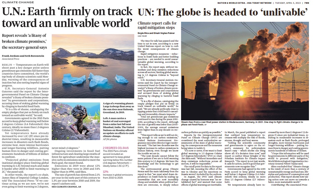
Local coverage today on the UN update:
Oregonian front page, SJ supplement deep interior

With the new UN Climate Report out, and our own Climate Action Plan a little stalled, and also with Our Salem still in progress, it might be prudent to hold off, and not send it to the ballot in November. For it looks still too strongly to 20th century standards, and not enough to our 21st century exigencies. Even when the projects were identified more recently, the designs and project scopes themselves respond to best practices of the previous century, not yet to a vision of the city we want and desperately need to have in 2050.

If this is going to be the big bond for the next 10 years, our big opportunity, shouldn't we be including more assertive climate action in it? Without a stronger sense of vision and values behind it, and instead relying on older lists of unfunded projects compiled under a different set of assumptions, the list feels more than a little ad hoc and a la carte. The process almost looks like a set of competitive applications for inclusion in the funding source. 

A better approach might be to ask what high-level outcomes we want and then to select projects that instantiate those.

Here are a few notes on a small number of transportation items. It's hard to grasp a pattern, and perhaps later there will be a better way to nutshell things. Or maybe you will see things more clearly.

Tuesday, September 4, 2018

Winter-Maple Greenway, 25th and State: ODOT Project Scoping at MWACT

The Mid-Willamette Valley Area Commission on Transportation meets on Thursday, and they'll be seeing a preliminary list of projects for State funding in the 2021-2024 cycle.

There's not a lot of information here, and once they get farther along and SKATS takes a look at them, there might be more to say. It's also not exactly clear how far along they are in the scoping process and how many projects (or how much dollar value) will fall out as the vetting continues.

Still, there are three projects being scoped that would significantly help walking and biking in Salem.

25th & State (the spreadsheet is not a very clear scan)
The project for 25th and State "includes median island on west leg of intersection to improve visibility of pedestrians; realigning crosswalk on east leg...; upgrading ADA facilities...extending left turn pocket for westbound to southbound movement..."

The crosswalk improvements would be helpful. You might remember neighborhood advocacy on this intersection even before the State Street Study kicked off. At the same time, because the Study embraced the "hybrid" plan rather than a full 4/3 Safety Conversion, the engineering and design for this project will be different than it would have been under the 4/3 conversion, and it is even possible that the four-lane cross section will be locked in.

That's just something to monitor.
Commercial St between D & Union
The Commercial Street project from D street to Union Street includes new bike lanes, in an area that has lacked them.

That's also at the new UGM/Police facilities.

Winter-Maple Greenway package
The project on Cherry Avenue at the Parkway includes "pedestrian refuge islands," a "bike signal" at the intersection with Auto Group Way, and a "separated bike boulevard between Auto Group Way NE and Salem Parkway," all part of the Winter-Maple Greenway package.

Sunday, August 12, 2018

City Council, August 13th - Good Cents

City Council meets on Monday and from here there's mostly just several things to note in passing. The most interesting item might be the update on the Public Art Commission and new information on the proposed Bottle Bill commemoration.

Proposed Bottle Bill commemoration near SAIF
The Public Art Commission will give an annual report, and in it is information about "Good Cents" by Lillian Pitt and Mikkel and Saralyn Hilde:
In February, the City of Salem (Oregon) Public Art Commission in conjunction with the Oregon Environmental Council (OEC) solicited conceptual designs from experienced artists or artist-led teams to develop a three-dimensional outdoor artwork that addresses the significance of Oregon’s landmark Bottle Bill. A total of $30,000 was made available from the OEC and the City of Salem for this opportunity including design, artist fees, fabrication, transportation, installation and documentation.

The Pitt-Hilde team has proposed a brushed aluminum sculpture 10 feet in height, incorporating the use of recycled materials in its fabrication....Through the design, the team is intending to honor ancestors by drawing on basket designs, petroglyphs and pictographs; employing symbols referencing the bottle bill; showing respect for nature and sustainability, and inspiring healing and understanding. The art work will be installed in section of the City’s Mill Race Park on the south side of Trade Street between High Street and Church Street....

This is one work commissioned by the Oregon Environmental Council to celebrate the 50th anniversary of its public policy work in Oregon. Artwork commemorating the Beach Bill will be sited in Cannon Beach; Land Use will be addressed on the Portland State University campus in Portland. Senate Bill 100 - the land use planning law that protects agricultural lands and reduces urban sprawl - will be commemorated with an art project at Sokol-Blosser Winery in Dundee.
I have trouble reading the sculpture; I'm not sure it works. One the one hand it looks like a 1970s corporate logo, or a "Where's Waldo" figure, but then there's this petroglyph motif for the face. Pitt is a respected Native artist, and so it's not just an instance of appropriation. Maybe it's artful collage, but it reads at the moment here like awkward mash-up. Not sure about this one. It will be interesting to read and hear what other people think. (Do you have an opinion of it? Here also is a similar work by the team at another site.)

Tuesday, July 24, 2018

From Carpenter Gothic to Masonry Mixed Use: Transition on Liberty Street

Reed Opera House, 1893
Gothic house demolished for McCornack Addition
(Salem Library Historic Photos)

Future Site of Montgomery Ward Building, circa 1936
A different Gothic house to be demolished
(Salem Library Historic Photos)

The Montgomery Ward Building, 1939 -
Left to right: Gray Block (edge), Eckerlin Building,
MW, McCornack Addition, Reed Opera House (edge)
(Salem Library Historic Photos)
We don't have a lot of photos that might give us a before-and-after look at main street commercial redevelopment here in Salem.

Sunday, July 22, 2018

Transition on Keizer's Pugh House Suggests Questions on State Street

You probably saw online or in the paper the story about the Pugh-Hall-Savage House in Keizer on the rise at Chemawa and Verda, overlooking Claggett Creek. (And more in a previous note here.)

According to the article it never was dated securely: It's casually suggested it must have been built prior to 1875 and associated with the Pugh family, but an ODOT consultant earlier had suggested a date in the mid-1880s and an association with the Hall family, who purchased the land from the Pughs. The difference was not resolved. Either way it was thought to be the oldest extant house in Keizer.

via Keizer Times in 2016
(the back side of the house)
But it's gone now, presumably to be replaced by apartments.

The new zoning proposed for State Street has got attention because of its proximity to, and potential for shadows on, the Court-Chemeketa Historic District, but in important ways the more immediate impact will be to historic structures on State Street itself.

A real question about the zoning proposal is what collateral redvelopment will occur that might not be the primary aim of the re-zoning. More generally, is the zoning truly going to do what we want it to do? As I have zoomed out from a specific interest in elements of the street redesign, I am beginning to wonder if we are still using tools too crude and mismatched to our real aims. (If you were focused on the zoning from the start, this may be old news or uninteresting to you!)

Friday, July 20, 2018

City Council, July 23rd - Safe Routes Applications and More on State Street

Council meets on Monday and there's a lot on the agenda. Revisiting the State Street Plan and approval for applications to the new Safe Routes to School funding program lead our interests here. There are several other items that involve parking or transportation.

So it looks like Staff are dissatisfied with the way the State Street Plan shook out? Not only is the Plan back on the agenda, Staff appear to be hinting strongly for some additional tweaks.

The report says "Staff has provided additional information below for consideration." (hint, hint)

From a previous presentation and earlier round of height reduction
Mostly it's about building height and ensuring with more detail that the proposed changes accommodate both residents of the Historic District's wishes as well as the larger goals to spur redevelopment. The trade-off of a reduction abutting the District and an increase elsewhere seems like a good one.

From the Staff Report:
  • The maximum building height abutting National Register Residential Historic Districts could be lowered to 50 feet in the MU-2 zone to ensure that the lower height applied to all MU-1 and MU-2 properties abutting the Court-Chemeketa Residential Historic District.
  • A maximum building height of 45 feet may or may not accommodate a four-story building that complies with the development standards in the MU-1 zone. Further reducing building heights could hinder the development potential of properties on State Street. It could also result in the development of fewer multifamily units, which are needed in Salem. The 2015 Housing Needs Analysis specifically determined that the Salem area has a projected 207-acre deficit of land for multifamily housing based on a 20-year population projection.
  • Staff conducted outreach to property owners during the State Street Corridor Plan project to discuss the proposed MU-1 and MU-2 zones and how their properties, if rezoned, would be impacted. In those property owner meetings, staff first presented the proposal of a maximum height of 65 feet in the MU-1 zone and later presented the lower 55 feet maximum height. For properties in the Commercial Office (CO) zone, this represented a reduction from the maximum building height of 70 feet allowed today. (The CO zone is adjacent to the Court-Chemeketa Residential Historic District between 14th and 17th streets). Staff did not propose a lower height of 45 feet when meeting with property owners that could be rezoned to MU-1 or MU-2.
  • The overall maximum building height in the MU-1 zone could be increased to 65 feet, as previously proposed by staff, to offset a further reduction in height to 45 feet for properties abutting National Register Residential Historic Districts. This would help ensure that the MU-1 zone retained its overall development potential, aligning with findings of the economic analysis conducted as part of the State Street Corridor Plan project. That analysis found that there is more momentum for redevelopment in this western half of State Street due to its proximity to catalyst areas such as Willamette University, the State Capitol, and downtown.
Still, even with putting all the parking in back so there's no mass there to cast a shadow, the project team earlier in the year showed a four story development of the sort that is desired, but still didn't pencil out.

Saturday, July 14, 2018

City Council, July 16th - State Street Study and Public Hearing

Council meets on Monday for a special meeting and formal Public Hearing on the State Street Corridor Plan. There is one item only on the agenda.

As new comment has come in, mostly it's a rehash of support or opposition, trading more on sentiment than fact or probability. There's a lot of fear and anxiety around change.

A couple of new items might be worth noting, however.

The current study repeats a lot of themes!
With their formal letter of support, SESNA cited a 1995 study that shows the pent-up, long-standing desire for a better State Street. I hadn't seen this called out before.

A group of Salem Area Realtors seems to echo this, but crucially they display our autoist incoherence, supporting the zoning changes but not road design.

Friday, June 22, 2018

City Council, June 25th - State Street Study

Council meets on Monday and they'll start considering the recommendations from the State Street Study.

Ordinarily there has seemed to be a clear path to adoption, but because of a major autoist change recommended by the Planning Commission, as well as particularly vocal dissent from residents in the Court-Chemeketa Historic District, the Study has been contested and it's not obvious what Council will decide. The Staff Report lists four options:
  1. Set a public hearing before the City Council on the proposed amendments;
  2. Proceed straight to second reading for enactment;
  3. Refer the proposed amendments back to the Planning Commission for further deliberation; or
  4. Decline to advance the proposed ordinance.
The right thing to do is a full 4/3 safety conversion the full length of State Street.

Bowing to neighborhood politics, Staff Recommends only a four block section of conversion from 13th to 17th, but the Planning Commission didn't support even this and instead wants to maintain a set of four full auto travel lanes.

So the process still remains in thrall to our autoist appetite.

Separately, some residents from the Historic District tried to insist on an additional layer of Federalized process because of indirect effects from State Street onto Court Street properties.

The State of Oregon said, "Nope, not necessary."
On March 29, 2018, the City of Salem asked for a determination from the State as to whether a review under Section 106 of the National Historic Preservation Act is required as part of the State TGM grant to the City of Salem for the State Street Refinement Plan (SSRP).

The Oregon Department of Justice (DOJ) has researched the issue and advised us that such a Section 106 review was not required as part of the TGM Grant. The provision of funds from TGM to the City did not require a Section 106 review as the project is planning-level only and does not involve bricks and mortar activities or ground disturbance or excavation.
There's nothing new to say on the subject unfortunately.

For more detailed comment on the State Street Study, see these main posts:
(For all previous notes on the State Street Study see here.)

There's an update on the Age-Friendly initiative, and it points to our problems with the State Street Study:
The group will continue to gather more information for the remainder of the evaluation process with the primary goal of assessing: How does the community support people moving freely around Salem to connect to goods and services without the reliance on personal automobiles? [italics added]
Those with an interest in trees should pay close attention to the proposal at what had been our "sustainable" office park. The City proposes to make new lots to protect some trees, but cut down others in order to facilitate development.
Currently, proposed development, and potentially oak removal, on this property is subject to City Council (Council) review prior to approval of development plans. This adds complexity and uncertainty to the site plan review and permitting process. To provide greater certainty to potential developers, the proposed lot configuration will create two lots that will be platted and retained under City of Salem (City) ownership to protect the majority of Oaks on the property (Attachment 2). The City land use process will be followed to modify the existing approved subdivision for the property to create three large lots available for development.
This just looks a little funny, kinda greenwashy, and like more retreat from our "sustainable" goals. Maybe it's a good solution, but it deserves scrutiny.

And out at the airport there's a street vacation for a new access drive near 25th & Madrona. 

It looks like a nice weekend for the first one of Summer, and so enjoy it! Maybe we'll come back to this and think more deeply on these, or think about other items on the agenda. (Maybe not!)

Tuesday, May 1, 2018

State Street Plan Continues at Planning Commission Tonight

The Planning Commission meets tonight, May 1st, at 5:30 in Council Chambers for the continuation of the Public Hearing on the State Street Study and Plan. (Agenda, and Supplemental Staff Report.)

Why Staff chooses not to support a full 4/3 safety conversion
I don't think there is very much to say about it - very little new or interesting comes to mind. The Staff Report - and crucially, the public comment to which it is largely responding - is repetitious. (See below for links to previous notes.)

So I just want to underline one small detail.

If we object to the consequences of a set of projected traffic volumes for 2035, then broadly two approaches come to mind:
  1. We can wring our hands, bewail and moan, and accommodate those future consequences with partial mitigation (and sometimes new roads), but mostly just manage with sighs and acceptance; or,
  2. We can make a determined effort to head off those projections and actually try to reduce traffic counts
So why is there so much acceptance of door #1?

If we don't like traffic, why don't we make every effort to reduce the frequency of driving trips and to reduce the length of driving trips?

Instead our current approach is fundamentally incoherent: We say we don't like congestion and traffic, but systematically we do nearly everything we can to accommodate and subsidize driving. We induce more traffic while we make futile and largely symbolic gestures to try to ward it off.

No wonder we fail. Until we are willing to grapple explicitly with this incoherence, we're just going to keep failing.

For more detailed comment on the State Street Study, see these main posts:
(For all previous notes on the State Street Study see here.)

Monday, April 2, 2018

State Street Study at Planning Commission Tuesday

The zoning and street concepts generated by the State Street Study are going before the Planning Commission tomorrow, Tuesday the 3rd at 5:30pm, and the boo-birds are out. It will be interesting to see just how much criticism the Plan attracts and how forceful it will be. (Agenda and Staff Report)

If State Street were fully built up, some winter shadows
might fall on the south side of Court Street
Earlier, an architect recently moved into the Court-Chemeketa Historic District submitted comment to City Council. They offered several very detailed criticisms of the plan and the process, and generally seemed to want to delay it, hoping perhaps to invoke a higher level of federalized process. In particular, they want lower building heights on State Street:
Shadows on properties where the owner wishes to harness solar power to save monies on utilities could have a significant financial impact on the ability to save monies and/or make the decision to make a capital investment for solar equipment. Although there is no right to light statutory framework within Oregon, it seems that before something is going to reduce a property owner's ability to conserve electricity, an analysis should be made. Under the current zoning, such information could be weighed in by the Planning Commission in deciding whether or not to approve a proposed project and/or propose mitigation measure, but under the proposed zoning, an administrative approval could be issued and then the property owner would have secured rights to eclipse a neighbor's property risking disputes and potential claims and litigation....

Since the proposed zoning changes will permit, by right, 55 foot tall buildings and potentially cast significant shadows into the National Register District located north of the State Street Corridor, causing a change in the character of the District's use or setting and introducing incompatible visual, atmospheric, or audible elements; we request that a Section 106 review be conducted. We further request that the City of Salem Historic Landmarks Commission be designated as the consulting party for the City of Salem and that neighbors directly affected or the North East Neighborhood Association (NEN) also be designated a consulting party.
This is interesting because an important element in opposition to the Salem River Crossing has been stalling afforded by the requirements of process. So you might say "what is sauce for the goose is sauce for the gander." But here the process is still unfolding, and the stalling on the SRC was necessary only because the process was so profoundly flawed. It was a tactic of last resort. Since the process is still unfolding here, and since the proposed changes are nowhere near as monumental as the SRC, this seems like a disproportionate response.

Friday, March 9, 2018

City Council, March 12th - State Street Study

Council meets on Monday, and they look to initiate adopting the State Street Corridor Study and its recommendations. At present, the City's approach to transportation remains compromised, maybe even just plain broken. The City is not yet willing to question its primary commitment to facilitating drive-alone trips. We see this clearly on the Salem River Crossing, where the Congestion Relief Task Force is still charged with facilitating capacity for drive-alone trips, and not with rethinking cross-river mobility and actually reducing drive-alone trips. Notwithstanding policies in the Comprehensive Plan to "reduce reliance" on drive-alone trips, our de facto approach and prevailing culture across multiple transportation planning projects is to maintain and expand autoist levels of service and induce additional drive-alone trips - with the harm to safety, pollution, and livability this entails.

Here on the State Street Study, instead of advocating for a 4/3 safety conversion the full length from 12th to 25th, the recommendation is for a 4/3 safety conversion for only 4 blocks, from 13th to 17th.

4 blocks of new bike lane
doesn't much solve gap on State Street corridor
(Salem area bike map)
Narrowly, from the perspective of a person bicycling, this is not very helpful, and is just one more instance of piecemeal approaches that leave gaps and incomplete corridors.

via Twitter
More generally, the approach prioritizes auto speed and auto capacity at the expense of safety for all road users, especially on the eastern segment between 17th and 25th. Compared to "no-build" or the "improved four lane" configurations, under the preferred "hybrid" some intersections are predicted for a "slight improvement" and at others crashes are expected to "increase slightly." This nets a wash, well within any margin of error for the analysis. The end result is inertia for the status quo and forgoes a meaningful improvement to safety.

Friday, January 26, 2018

Prospects for State Street look a Little Dim

The Presentation to the State Street Corridor Committee has been published, and it doesn't look very promising.

More than anything, by themselves rents are not high enough to induce the desired redevelopment.

Four stories of retail and housing: Ideal

Doesn't pencil out
So we are in a terrible "between" state: Rents aren't high enough to attract new development and we don't actually want rents to go up because they're too high already. This is messed up.

Tuesday, January 23, 2018

State Street Corridor Study Advisory Committee meets Today

Tonight, on Tuesday the 23rd, the Advisory Committee for the State Street Corridor Study will meet at the Library at 4pm to talk about the proposed zoning.
The committee will review revisions to the proposed mixed-use zones on State Street as well as an analysis of development feasibility. The committee will also discuss the preferred street design
The chief element that seemed to be contested were the building heights, and both the MU-1 and MU-2 list 55 feet as the maximum at the moment.

At least in the published materials, it has not been discussed whether this will actually attract the development we want to have. Would 70 feet actually spur more reinvestment there?

It might seem great that the heights have been reduced in response to neighbor complaints, but if the reductions are such that they hamstring the whole concept and hinder or even halt the desired redevelopment, maybe the reduction isn't such a great idea after all.

Presumably the "development feasibility" discussion will touch on this.

Parking in back, forecourt alcove, corner entry
Still, there are lots of good things in the two zones:
  • The fronts of commercial buildings meet the sidewalk and have lots of windows
  • Forecourt alcoves can be featured as pockets of quasi public space
  • Parking in back
As for the street design, we should continue to lobby for a full 4/3 safety conversion. Doing it only half-way compromises its effectiveness!

Sunday, October 15, 2017

Understanding Safety: Crash Rates vs Counts on State Street

One of the claims here is that making distracted driving our primary safety focus is a kind of error.

It attacks a secondary problem or phenomenon or factor rather than the primary one. It's not an error in the sense of something false, but is an error in the sense of something misguided or inefficient.

The new cellphone law
Behind that focus on distraction is an analytical preference for rate statistics rather than counting statistics, it seems to me.

When we focus mainly on distracted driving, we say we will keep the rate and amount of driving more or less the same, and we are going to try to squeeze out incremental improvements in our rates of safer driving. It's really a kind of qualitative improvement: We're going to try to drive better.

In and of itself that is not an error of course. We should always try better! Distracted driving is a problem, and we should want to make inroads on that.

But that may not be the best approach to have as the primary focus.

A different approach would be to say that humans are fallible creatures and that since driving a vehicle weighing thousands of pounds at lethal speeds is inherently dangerous, it is more prudent and more effective to drive less distance, drive less often, and drive more slowly. Even if our rate of crashes remains the same, because we are driving fewer miles and making fewer trips and driving more slowly there will be fewer crashes and fewer deaths. This is mostly a quantitative argument.

A table of modeled crash rates on State - the dead are erased
(Tier 2 Evaluation of the Street Design Alternatives)

And a similar table for Statewide targets
(at SKATS last month)
Because at the end of the day, at the end of the month, at the end of the year, it is the number of dead people that matter. It's the count that matters. It's mourning 17 dead instead of 24. It's binary: dead, not-dead.

Wednesday, October 11, 2017

Draft State Street Plan Disappoints

Yesterday the City published the full draft State Street Corridor Plan as well as an abbreviated brochure.

Broadly speaking it disappoints and fails to express a thorough 21st century rethink on the corridor.

Incoherence and timidity is very clear in the brochure.

A chapter heading image shows a road diet
In a bit of a bait-and-switch they show a road diet on one of the images at the head of a "chapter."

Since the recommendation is not for a road diet (except the four blocks between 13th and 17th), a more representative image would have been a photo version of the four through-lane section, which is the majority of the corridor. It would be stroady, of course, and almost certainly not show a vibrant urban streetscape, but that's where the recommendation goes.

In the brochure they also discuss "Elements of Strong Street Design," at least implicitly pointing to the disjunction.

The elements of strong street design
The recommended "hybrid alternative" lacks many elements of a strong street design. (They could point this out more strongly, of course.)

The hybrid recommendation lacks
elements of strong street design
Our addiction to hydraulic autoism and a misguided attachment to "levels of service" analysis for 2035 has watered down and neutered the plan.

Wednesday, August 16, 2017

State Street Study has Consensus on Zoning, but not on the Street

The meeting summary and presentation boards for the State Street Open House last month have been out for a little while. There are no real surprises, but it might be worth visiting a few points.

The summary of comments suggest there is the outline of a consensus on zoning, but not on a street redesign.

Consensus on zoning, but not on the street
But before we talk about substantive matters, there is one tiny comment, buried deep in the summary, whose tone is arresting and which leaves me with the sinking, queasy feeling that it is a more dominant sentiment on the project than our polite society is usually willing to say:
  • Preferred alternative should focus on excluding low-income, transient populations and ensuring a better class of shoppers, tenants, and homeowners
Is that really the key to a lot of other criticism of the plan's concepts?

Monday, July 24, 2017

Talk on Downtown Value, State Street Open House, MPO - Tuesday

Tomorrow, Tuesday the 25th, has one talk, one open house, and one committee meeting of interest.

Don't forget about Joe Minicozzi at the Library tomorrow morning at 8:30. (More on it here, and two video clips here, here.)

Via Strongtowns and CNU Public Square


State Street Study Open House

Last month the City and consultant team published a set of draft concepts and is soliciting further comment.