The Cordon-Kuebler Corridor study just opened a second online open house.
There's a lot of detail, but if we take our Climate Action Plan seriously, Salemites should strongly support a framework based on Alternative No. 3.
There are two other alternatives, but they are very much in a 20th century and autoist mode.
 |
| Summary cross-sections (red, yellow added) |
The framing associated with the third alternative is unfortunate and skeptical: Look at this hard goal we have set. But if you really want to, we can try.
 |
| The mode shift goal in the third alternative |
But a different framing, one with a climate lens, might say, here is our mode shift goal and VMT reduction goal, which alternative helps us get there?
 |
| Look! Our CAP has the same 10% reduction |
As it happens, in Scenario No. 1, our Climate Action Plan contains a very similar goal for a 10% reduction in car driving and traffic volume.
 |
| Summary assessment on function (red, yellow added) |
That is our policy goal, and the framework in Alternative No. 3 is most consistent with that.
We should manage the whole of the Cordon-Kuebler corridor to that goal.
We should adopt some version of Alternative No. 3. That's the nutshell.
Here are some other considerations.
Safety
The way the materials frame "safety" are also unfortunate and biased.
I guess we are still at a place where a paint-only bike lane with a space buffer, maybe some plastic delineator wands, is considered plausible on a 55mph parkway. The first two alternatives, one with new traffic signals, the other with new roundabouts, widen the road to two lanes in each direction, and don't provide much additional separation for people biking.
The third alternative has better separation, and retains only one car travel lane in each direction.
Not in the Open House materials, but in the Alternatives memo, there is a table summarizing the safety analysis.
 |
| Safety assessment table (bright yellow added) |
It reproduces the confusion between less lethal, slower speed fender-benders in congested conditions with lethal high speed crashes in more free-flow conditions. This is an unsophisticated, perhaps deliberately so, understanding of safety.
 |
| Crash summary table |
 |
| Severe crash heatmap |
Crashes may increase as congestion increases, but the impact speed also decreases as congestion increases.
Four travel lanes will do more than "may increase speeds." They will in fact induce and invite speeding. The language is also hedging.
Widening the road to two full travel lanes in each direction will increase speeds. Period.
Urban Growth Boundary
 |
| Farmers advocating for compact cities |
Four full car travel lanes will also intensify pressure to blow up the Urban Growth Boundary, which runs along Cordon Road, and hasten its demise or expansion. That will mean more loss of "urban edge farms." (See the American Farmland Trust, "Farms under Threat.")
 |
| Safety and urban-edge farms in one story |
Traffic Forecasting
The traffic forecasting is also problematic and assumes "a large amount of growth in vehicle trips."
 |
| Traffic forecasting assumptions (yellow added) |
The modeling is full of pseudo-science and false precision. These numbers are forecasted for 20 years out!
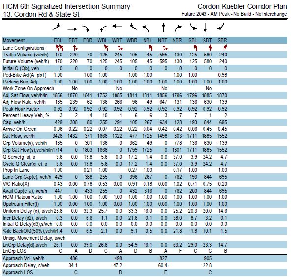 |
| Just part of the numbers on one intersection There are over 100 pages of this! |
Remember the error range on a meta-study of many traffic forecasts? Most forecasts overstated the actual number, and the standard deviation of difference was nearly 25%! A 40% error wasn't that uncommon.
 |
| A bell curve with lots of error |
Error bars and uncertainty should be a part of the reporting on the forecasting.


2 comments:
How the heck do decisionmakers present these options without any idea of cost?
Most major decisions I make in my personal life consider cost. With a project cost in the multi-millions, it feels that hiding the costs of major road expansions is a dishonest decision on the part of the county.
This whole process is frustrating because the notices for the Open Houses did not come to Neighborhood Associations for the first round, and then for the second one it came too late to get on their November agendas. Now the on line open house closes before the November deadline.
What is decided is key to how land use cases might be framed for future development. Marion County for example has already created conditions for Cordon Road on the large Pictsweet (East Park Estates) development. They are required to do improvements on Cordon, Auburn and State Streets. They would suggest that the County has already made some decisions. One that was clear was more lights, more turn lanes and 5 lanes.
The question is whether we see Cordon as another Lancaster Drive (much of which is actually in the county, not the City) or looks like an extension of Kuebler.
I assume that within 20 years the UGB will be pushed out and major development will be permitted east of Cordon. We at least need to be prepared with sufficient right of way to accommodate whatever is decided.
Post a Comment