You may recall that the City engaged the Urban Land Institute for a technical assistance panel report on jump-starting redevelopment of the Industrial parcels between Patterson Street and Wallace Road in West Salem. With the Pandemic (and perhaps other stuff), it got delayed, but they've finally published the report.
 |
| cover of report |
It came out in December, and then early this year parts of it were presented to the West Salem Neighborhood Association, but the City's never talked about it to any more general public or made it available on the City website.
 |
| No results found on City website |
The quiet has seemed a little odd.
In any event, one of the big ideas is to break up the existing industrial superblocks with new street segments. They even talk a little about Portland's smaller 200 foot block faces.
 |
| Big idea: Break up the superblocks |
They talk about:
- Extending Taggart south to Edgewater
- Extending Basset west to Patterson and east along the park margin to Glen Creek Road
- Extending Bartell Drive south across the path to connect with Musgrave
The overall concept for hubs and connectivity:
 |
| Hubs and Connectivity |
Even though they talk about the value of the Union Street Bridge and path, they were at ease suggesting Bartell cross it, and Bassett curve along it. And they showed Marine Drive erasing it.
So the details are not necessarily consistent with honoring walking and biking, even though it seems to starts off great talking about better walking and biking.
The concept of a light at Bassett might be the most interesting. An overpass is still expensive, and prioritizes auto travel.
The ability to bicycle and walk safely both within West Salem and across the river to employment centers in downtown Salem is also limited. A bridge over Wallace Road that extends the Union Street Rail pedestrian and bike pathway into the newly rebuilt 2nd Street is the place to start. Find creative solutions to connect more pedestrian and bike paths up the hilly bluffs to the residential area, such as at the end of Patterson Street, Garth Avenue, and beside Rosemont Avenue. The more options there are for safe and convenient biking the more residents will be likely to move away from automobile dependency....
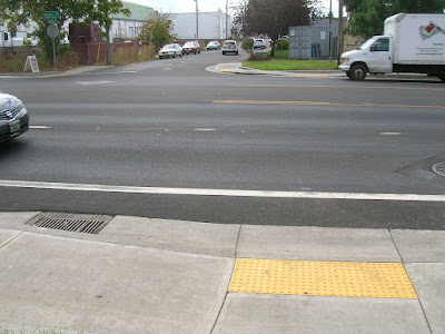
2nd street was previously considered as a Wallace Road crossing with an underpass. But at $30 million, the city deemed the underpass too expensive. A stoplight for an at grade intersection there is problematic with the Oregon Dept. of Transportation (ODOT), which controls Wallace Road, because it is too close to the bridge. The solution across Wallace is an at grade signalized crossing at Bassett Street, which is further from the bridge.
 |
| A light here at Bassett Street? |
The study as I understood it was to focus on more short- and medium-term concepts.
The focus of the TAP would be on near- and mid-term strategies to employ during this transition, attract development interest, and leverage our TIF strategically.
Nevertheless, it goes long in places, rather pie-in-the-sky, and talks about a new bridge and wild changes to OR-22.
In the long-term, a pedestrian and bike bridge across the Willamette River from the study area to Minto-Brown Island Park would complete the Union Street to Waterfront Park circle. This would give better access to this amenity from West Salem and be an impressive attraction for the city....
In the mid-term, plans should begin to slow down Highway 22 on the west side of the river as it now does in downtown Salem. Converting it to a boulevard that continues to the western edge of urban West Salem creates the potential for crossings to the undeveloped riverbank west of Wallace Marine Park. In the long term, regional thinking about the movement of goods through the Willamette Valley should include planning to remove Highway 22 altogether from passing through Salem. This would completely open up access to the river from the west bank.
It is fascinating that they recommended OR-22 for boulevardization and not Wallace/OR-221 for a stroad-to-boulevard treatment.
And that to me suggests they didn't engage deeply enough with the close-in, flat portion of West Salem as it actually is.
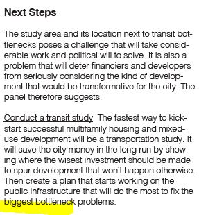
They also still seemed hemmed in by autoism, even as they used words like walkability. The "next steps" led with a discussion of "bottleneck problems." They talked about a "transit study" but they really seemed to mean an auto traffic study.
 |
| Autoism of "Bottleneck problems" |
They stressed "how to accommodate parking" as if that was a primary problem, and not a very secondary one.
 |
| Parking Mania |
 |
| Parking Mania Again |
I found more persuasive the discussion west of Wallace Road, and in particular the need to break up the superblocks and restore a smaller street grid.
I did not find very persuasive the discussion east of Wallace Road, and in particular they way they were at ease encroaching on the path system and park edges.
Even though they nodded to walking and biking, the recommendations focused on big expensive things like an overpass and bridge that get people on foot and on bike out of the way of cars. They still, it seemed, prioritized autoism.
In the end I did not find the study compelling on near-term concepts for redevelopment and on things that actually reduce driving. Is there really a road map here for the City to jump-start redevelopment? Hopefully the City will comment more publicly on this.
Perhaps the disconnect is not surprising. Nearly 20 years ago ULI performed the same kind of analysis on the Boise redevelopment. Few of their recommendations made it into reality. (Comments here in 2013.)
 |
| Urban Land Institute Report, 2006 (click to see added notes in red) |


No comments:
Post a Comment