While acknowledging the importance of improving non-vehicular modes of transportation-including pedestrian, bicycle, and public transit-and the possibility that other travel demand management measures-such as changed work hours-the work of this Task Force is to be directed primarily at identifying opportunities for improving vehicular mobility and ways to reduce vehicular congestion within the study area.Here are two perspectives, both of them essentially true, but probably not equally true:
- Politics is the art of the compromise. At the present moment, this may be the best we can agree on, and it's better than the stalemate on the Salem River Crossing itself.
- This is manure! We already know what we need to do. There is no reason the City should not commit whole-heartedly to the recommendations in the Alternate Modes Study as well as the earlier Bridgehead study. Just do it! Quit screwing around with new committees. And the way to manage congestion is not to improve "flow." We need instead to talk about total mobility and to offer other kinds of mobility so that people have realistic choices instead of drive-alone trips.
This argument [on the SRC] has gotten us nowhere, except an atmosphere of divisiveness, hostility and differently colored t-shirts.But the Task Force's restriction on "primarily at identifying opportunities for improving vehicular mobility and ways to reduce vehicular congestion" - and here even though bikes are generally considered vehicles, the meaning is clearly to exclude them and to construe "vehicles" as automobiles only - already rules out a number "real, affordable solutions."
On this issue, and many others, I am eager to focus on areas where we can find common ground. In this debate, the common ground is this: we have a peak hour congestion problem downtown and in West Salem and we need to fix it....
I am eager to work toward real, short term, achievable solutions to this situation. We can effectively address this issue by coming together and focusing on areas of agreement and implementing real, affordable solutions. We won’t agree on everything – and that’s perfectly fine. But we can all agree that we need a solution now to our peak hour congestion problem downtown. Through several discussions, there is a vehicle to bring this effort to fruition on Monday night’s City Council agenda. I look forward to enthusiastically supporting this motion.
There are substantive grounds here for criticism of the proposal.
Back in 1980, nearly two generations ago, we knew things, and we mostly blew them off.
- [There will be a need for] A substantial increase in use of transit, carpooling, bicycling and walking, and perhaps the introduction of peak-hour shuttle systems between downtown Salem and West Salem.
- More attractors (employment, shopping, entertainment, schools) west of the river
 |
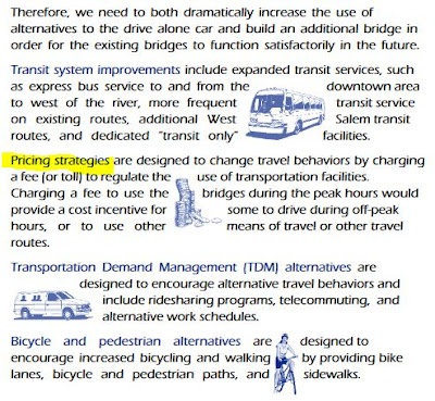
| Decongestion pricing recommended circa 1998 (Willamette River Crossing Capacity Study brochure, undated, via the Internet Archive, crawled in 2004) |
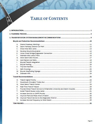
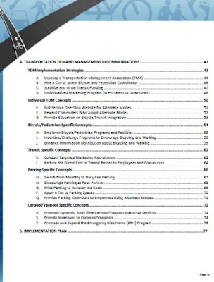
A few years ago, the Salem River Crossing Alternate Modes Study proposed a large suite of measures.
We have not pursued these very passionately, either.
So for the resolution to say, again,
While acknowledging the importance of improving non-vehicular modes of transportation-including pedestrian, bicycle, and public transit-and the possibility that other travel demand management measures-such as changed work hours-the work of this Task Force is to be directed primarily at identifying opportunities for improving vehicular mobility and ways to reduce vehicular congestion within the study area.
 |
| Improving vehicular mobility is not supposed to be our first choice |
(As for the specific mechanism in the SRC process for disparaging non-auto solutions, and on which the current proposal still seems to depend, see "The Origin of the 8% Reduction is a Rhetorical Sleight of Hand!")
The resolution also digs in on an odd interpretation of the final Environmental Impact Statement and Record of Decision.
When completed, the process will yield a Final Environmental Impact Statement for a new facility, not the facility itself. We understand that even with a Final EIS in place, it may take another decade or more to fund, design, and begin construction of a new bridge.The Environmental Impact Statement is not about some general, conceptual notion of a bridge somewhere across the Willamette River. It is about a very specific bridge configuration. Supporters of the bridge quibble on the word "design." Many small details are not yet "designed." It's true that the "design" of the hand railings and the "design" of the concrete mix are not specified in the EIS, but the number of traffic lanes, the location of on-ramps, even the kind of span and location of piers, is called out. The FEIS does define key characteristics of "the facility itself" and to maintain otherwise is to mislead and trade on a false sense of "design."
Finally, the concept of induced demand suggests that congested systems seek an equilibrium. If you take cars off the road and put passengers on the bus, new drivers will take up the "slack" in travel time and travel space and fill the road again. This is why economists argue that decongestion pricing is the only real solution and that lawmakers are finally beginning to realize we can't build our way out of congestion. It is likely not at all possible to "fix" the peak hour congestion problem. It is an autoist fallacy that there exists any kind of permanent solution that will yield free-flow.
So on substantive grounds there are real reasons to think this new proposed Task Force might just be bunkum.
As process, it almost reads like make-work for a delaying action in hopes that the election in November, 2018 can elect new Councilors and rebalance Council in favor of the SRC.
On the other hand, as a matter of politics, maybe this is the best thing to do right at this moment.
Probably it occupies a center zone on which reasonable people can disagree and it is not worth opposing or praising very passionately either way.
Other Stuff
 |
| Johnson Heights to Fred Meyer |
The proposed subdivision is ideally situated within ½ mile of the intersection of Madrona Avenue and Commercial Street S.E. Safe and convenient bicycle and pedestrian access is provided from the subject site along Madrona Avenue to the neighborhood activity center and further along Commercial Street. This criterion is met.This reflects a system problem. Drawing a line on a map appears to show "connectivity." As the crow flies, sure, it looks easy to walk or bike along Madrona to Fred Meyer on Commercial!
 |
| Johnson Heights to Fred Meyer - Madrona in yellow (Salem area online bike map) |
That's not a reason to oppose the subdivision, but just to point out the inadequacy of our framework for thinking about non-auto connectivity, here especially bike connectivity. With lines on a map we satisfy certain formal requirements for "safe and convenient" bike access, but the result on the ground doesn't correspond to anything a parent and child, or an elderly person, would recognize as "safe and convenient."
Two other instances of infill also:
- A 46 lot subdivision along Croisan Scenic Way between Belcrest Cemetery and Madrona.
- A Public Hearing for a street vacation by Capital Manor for infill housing there also.
And you already know about the misguided "Pedestrian Safety Study," which Council will discuss at a Work Session before the formal Council meeting itself.


1 comment:
Bridge- Money. End of story. Until we get some money, the project can't move forward. So, working on things around the existing bridges until we can figure out where to to the money for another bridge seems reasonable.
I am one of those West Salem residents who has lived in Salem for most of my 60+ years. If we could not get the needed money for another bridge back when Senator Hatfield was chair of the Committee that gave out federal dollars, how can we hope to get it now. Tolling is so odious to most Oregonians (sort of like sale taxes) might be good in theory, but I don't think it is likely. So doing something IMHO is better than doing nothing.
Subdivisons - We all want to see more housing, but the 46 lot subdivision along Croisan Scenic Way between Belcrest Cemetery and Madrona has a serious issue. It is in two parts. The part along Croissant Scenic Way is long over due. I was involved in hoping to plan that old Christmas tree farm back in the 1990s and it will be welcome in some ways because it completes a through street in the area. The second half is on Dogwood and it involved developing a very steep piece of property. It has a lot of issues aside from it being at a grade that is beyond our current standard (they are asking for a variance for the 12% rule) and they look to be cutting down a large number of trees that have stabilized the slope for decades. Cutting all those trees and putting houses where extensive cut and fill is needed, is kind of scary. The former property owner knew this and wanted it kept in a natural state. But now the desire to do all kinds of in-fill is going to perhaps open up some new development to more slide potential.
This quiet area is going to see a lot of change and more traffic. Some people call that progress.
Connectivity and land use application statements - Long been a gripe of mine that anytime there is a criteria that needs to be met by a developer such as connectivity or impact or whatever, all the developer seems to need to say is 'it meets the criteria' without any real evidence. The staff in turn does the same thing. They can say, 'the criteria is met' and it is. If a neighbor wants to protest or argue to the contrary, they have to have a preponderance of evidence, special study by approved professionals, and even then almost never can prevail. Something in that process needs to be changed so that we can have realistic planning that benefits the whole community.
A line on a map, has very little to do with human behavior and so alone is useless
Post a Comment